Issue Date: Friday, July 17th, 2020
Issue Time: 10:40AM MDT
Summary:
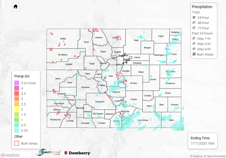
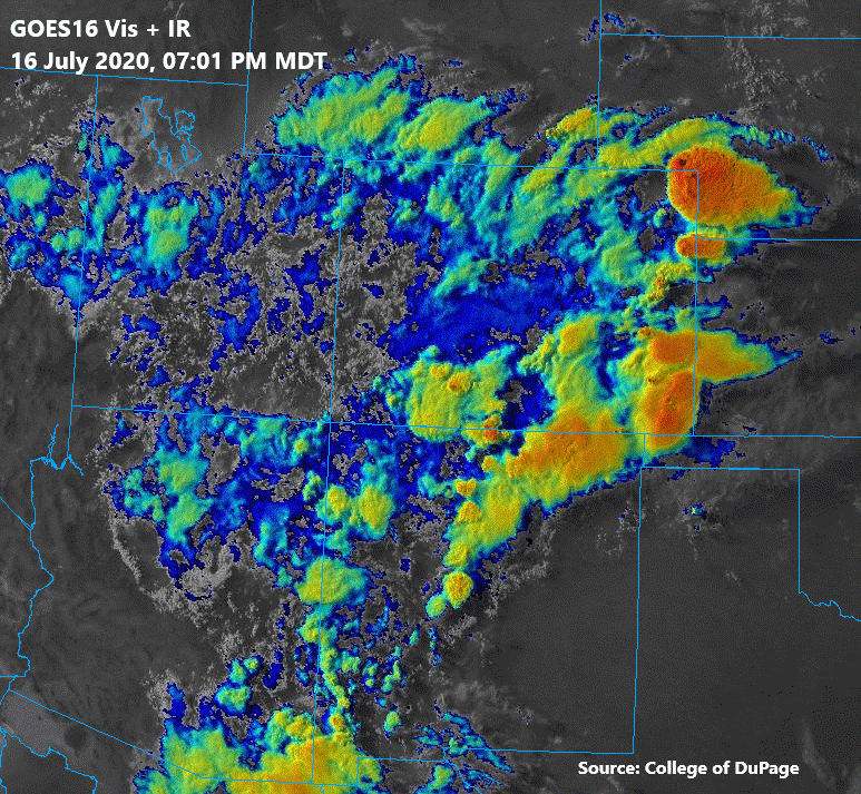
Scattered thunderstorms and showers brought beneficial rain to much of southern Colorado, with many areas receiving up to 0.6 inches of rain over the San Juan Mountains, Southeast Mountains, San Luis Valley, and Raton Ridge. Additionally, a couple storms were able to drop just over an inch of rain over the southeast and northeast plains. Several hail reports up to 2 inch diameter were submitted over far northeastern Colorado as a storm was able to tap into increased moisture along the eastern border. The GOES16 visible + infrared “sandwich” image below shows the clouds and storms over Colorado as of 7PM MDT, including some of stronger storms that formed over eastern Colorado. The highest CoCoRaHS 24-hour rain report of 1.15 inches came in from far western Baca County, where an isolated thunderstorm was able to re-develop over the area for close to 2 hours. This area also had another storm roll over around 6PM MDT, which likely boosted the 24-hour rain total over 1 inch. The QPE map shows this bullseye of rain totals up to 1.5 inches associated with these isolated storms in western Baca County. Another bullseye appears in the QPE map over central Kit Carson County with just over 1 inch estimated, which was due to a couple of thunderstorms tracking over the area after 6PM. The closest CoCoRaHS rain report was up to 0.38 inches just north of this area. No flooding was reported with these storms yesterday.
Back over the western high terrain, a heavy rain report of 0.25 inches was sent in from Pagosa Springs. Being that southern Colorado has been experiencing extreme drought, this 0.25 inches was very welcomed. The Moon Pass SNOTEL station in the northeast San Juan Mountains reported 0.80 inches. QPE in the area was likely underestimated a little. There was also a 0.39 inch report from an ASOS near the 416 burn area. CoCoRaHS observations over the San Juan Mountains were in the 0.15 to 0.30 range. The interior San Luis Valley even got a little rainfall with the widespread storm coverage (under 0.10 inches), and the southern portion of the Valley and edges had reports up to 0.50 inches. Over the Central Mountains, the highest observation was 0.15 inches in Carbondale.
To see how close you got to receiving some rain, check out the 24-72 hour rainfall estimates in your area on our State Precipitation Map below.
Click Here For Map Overview