Issue Date: Monday, July 13th, 2020
Issue Time: 10:55AM MDT
Summary:
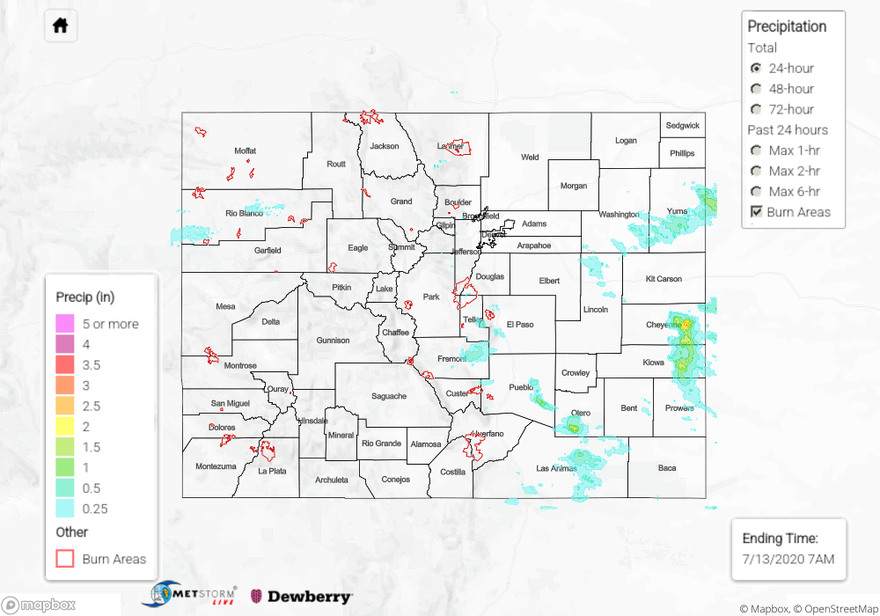
Heavy rain fell in scattered thunderstorms over the Northeast Plains, Southeast Plains, and eastern Palmer Ridge regions yesterday. One particular storm had QPE estimated up to 3 inches over a couple hours between 7-9 PM MDT over Cheyenne Wells, CO. This caused Highway 385 to flood and prompted the NWS to issue a Flash Flood Warning at 7:07 PM MDT that was extended to last through this morning. CoCoRaHS 24-hr precipitation accumulations in Cheyenne Wells, CO were recorded between 1.50 inches and 1.80 inches, indicating the QPE map may contain a slight over-estimation of rainfall just to the east of town.
The “sandwich” satellite image (a combination of visible and infrared bands) from 07:26 PM MDT last night (see below) shows this intense thunderstorm with cold over-shooting cloud tops, indicating a vigorous updraft. The other thunderstorms over the eastern Palmer Ridge and Northeast Plains dropped hail up to 2.5 inches in diameter yesterday with numerous hail reports over 1.5 inches in Lincoln, Washington, and Yuma Counties. A few isolated areas in Pueblo, Otero, and Las Animas counties also saw decent accumulations, and QPE from thunderstorms was estimated at just over 2 inches of rain. No flooding was reported in the smaller storm cores as of this morning.

Back to the west, storms finally returned to the forecast with increased moisture over the region and large-scale dynamics helping to provide lift. Mostly, storms produced some very strong outflow winds (60 mph gusts) with the inverted-V soundings, but a few rounds of rainfall allowed some decent accumulations for the 24-hour period. Over the Northwest Slope, up to 0.5 inch of rain fell yesterday according to the QPE. A SNOTEL site in the Central Mountains recorded about 0.20 inches for the 24-hour period, and the highest CoCoRaHS observation was near Crested Butte (0.19 inches). Lastly, a wildfire broke out Sunday afternoon near Telluride and has currently burned about 60 acres. The cause of the fire is still unknown.
To find out how much rain fell near you over the last 24 hours, check out our State Precipitation Map below.
Click Here For Map Overview