Issue Date: Monday, July 13th, 2020
Issue Time: 9:40AM MDT
— Flooding is NOT expected today
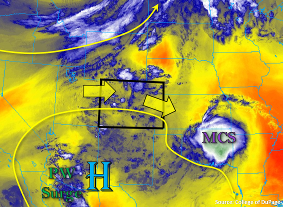
Flow aloft is expected to become more zonal today as the trough passes to our north and squashes the ridge. Between the High and the trough, there will still be plenty of mid-level lift moving across the state, and some upper air dynamics creating a little lift across portions of the northern border. As far as moisture, PW values should be high enough for another round of storms statewide. Currently, there are some ongoing showers over the Central Mountains with some reflectivity also over Moffat and Montezuma/La Plata Counties. Moisture at the surface is still fairly shallow, so the westerly flow will likely mix out this out quickly over western Colorado, the mountains, and I-25 corridor. This, along with not much instability being able to build with the ongoing showers, means storms today will generally only produce light rain rates and gusty outflow winds. However, coverage of storms over the mountains is forecast to increase, especially the Central and San Juan Mountains.
Higher surface moisture will again reside over the far eastern plains, but the surface low’s location should only allow dew points in the mid-50Fs and low 60Fs to maintain themselves along the border and east of the state. Also, storms will arrive the plains a little sooner than normal due to the first shortwave arriving earlier than typical, so this will limit the amount of instability that can build further north. Between these two factors, the severe threat will be over a smaller area (border counties) and generally, only moderate rainfall is forecast. Over the Southeast Plains, there is a chance that a severe thunderstorm will be able to generate rain rates just over 1.50 inches/hour; however, the areal coverage is expected to be small enough that no flood threat will be issued. If this flood threat area increases by early afternoon, a PM update will be issued.
Today’s Flood Threat Map
For more information on today’s flood threat, see the map below. If there is a threat, hover over the threat areas for more details, and click on burn areas to learn more about them. For Zone-Specific forecasts, scroll below the threat map.

Zone-Specific Forecasts:
Southeast Plains, Northeast Plains, Palmer Ridge, Raton Ridge, & Urban Corridor:
Moisture isn’t quite as high at the surface as it was yesterday, which means the westerly flow will more quickly mix it out from west to east. As storms move off the mountains, higher rain rates are anticipated over the Palmer Ridge. Additional storm formation should occur over the Palmer Ridge as the first shortwave moves off the mountains by noon. Max 1-hour rain rates up to 0.50 inches will be possible with lower rain rates for the I-25 corridor (0.25 to 0.40 inch range).
Further east over the plains, some severe thunderstorms will be possible again along the border. The best chance for a severe storm or two will be over the Southeast Plains due to a slight delay in arrival of a second shortwave. Severe thunderstorms that form this afternoon will be capable of producing 60 mph wind gusts, 2.25 inch diameter hail, and local, heavy rainfall. For the most part, max 1-hour rain rates should remain around 1 inch, but a stronger storm may be able to produce rain rates just over 1.50 inches. However, decent storm motion to the southeast and higher dew points over Kansas will mean the area of intense rainfall would be small enough that flooding is not expected. There could be some light showers over the eastern plains overnight, but the more likely scenario is just increased cloud cover.
Primetime: 12PM to 10PM
Front Range, Southeast Mountains, San Juan Mountains, Central Mountains, Northern Mountains, Northwest Slope, Grand Valley, San Luis Valley, & Southwest Slope:
Storm coverage is expected to pick up today with extra mid-level energy moving through the flow, which will also help increase moisture slightly. Max 1-hour rain rates up to 0.25 inches over the Central, San Juan, and Northern mountains will be possible with slightly lower rates over the valleys/elevated plateaus forecast. Over the Front Range and Southeast Mountains, coverage will decrease slightly with max 1-hour rain rates up to 0.25 inches possible. Again, the main threat from storms will be outflow winds with gusts up to 50 mph possible under the stronger storms. Mid-level energy will likely keep weak showers going over the Central Mountains overnight. Flooding is not forecast.
Primetime: Ongoing to 4AM