Issue Date: Friday, July 10th, 2020
Issue Time: 10AM MDT
— Flooding is NOT expected today
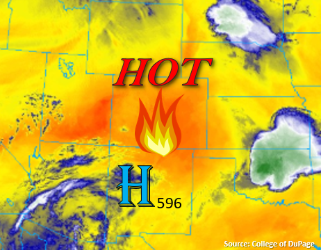
Today’s weather can be described by one word: HOT! The strong ridge, with the high centered to our south, will produce some very high temperatures this afternoon. Expecting most metro areas, the Grand Valley, and eastern plains to hit the century mark, and if they don’t, they’ll come very close to it. The PW values across the state are quite low (new record low value for Grand Junction), and a mid-level cap just about 3km over eastern Colorado will keep afternoon rain out of the forecast. So, all the atmosphere will be able to muster is some broken cloud cover over the mountains and western Colorado this afternoon and evening. A little heavier cloud cover is expected across the southern border as the disturbance in the image below (over NM/AZ) makes its way northward. Rainfall from that disturbance is not forecast.
Today’s Flood Threat Map
For more information on today’s flood threat, see the map below. If there is a threat, hover over the threat areas for more details, and click on burn areas to learn more about them. For Zone-Specific forecasts, scroll below the threat map.

Zone-Specific Forecasts:
Southeast Plains, Northeast Plains, Palmer Ridge, Raton Ridge, San Luis Valley, & Urban Corridor:
It’s going to be a scorcher this afternoon! Denver, Fort Collins, and Pueblo will all be able to reach that century mark making this the hottest day of the year so far (at the state level). Due to the slightly higher elevations of the San Luis Valley and Colorado Springs, high temperatures will be closer to the low-90Fs and mid-90Fs, respectively. Not expecting much cloud cover for relief from the heat either, so be sure to keep yourself hydrated.
San Juan Mountains, Central Mountains, Northern Mountains, Southeast Mountains, Front Range, Northwest Slope, Grand Valley, & Southwest Slope:
Expecting the mountain valleys to reach the high 80Fs this afternoon with 70Fs for most mountain towns. Highs will likely reach the century mark or flirt with it over the lower elevations of western Colorado. Some gusty winds are anticipated over the Northern Mountains and Front Range, so a Red Flag Warning has been issued. West winds are expected to reach the 10 to 20 mph range with gusts up to 30 mph possible from 11AM to 8PM this morning. It will be too dry for any rainfall, but some broken afternoon cloud cover can be expected.