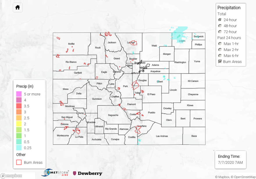
Issue Date: Tuesday, July 7th, 2020
Issue Time: 9:30AM MDT
Summary:
The heat started to crank up yesterday, and Grand Junction hit the 100F mark. DIA hit 97F just before 5PM. Some nice afternoon and evening cloud cover helped cool it off at the lucky locations. Storms yesterday were mostly high-based with limited moisture available, so they didn’t produce a lot of rainfall or large rain cores. The best rainfall coverage was over Logan County where just under a half inch fell. Storms looked more menacing on radar than they actually were. A CoCoRaHS gage north of Sterling recorded 0.40 inches of rainfall, which was the highest observation of the day. Another stronger storm formed over the Palmer Ridge and 0.36 inches of rain were recorded at a gage near Ramah in Elbert County. QPE estimated rain totals just over a half inch northwest and north of Limon. Back west, storms produced some gusty outflow winds over the Northern Mountains/Northwest Slope. A 50 mph gust was recorded in Craig with rainfall totals estimated below 0.05 inches in the area. Flooding was not reported.
For precipitation estimates in your neighborhood over the last 72-hours, scroll down to the State Precipitation Map below.
Click Here For Map Overview
