Issue Date: Tuesday, July 7th, 2020
Issue Time: 8:55AM MDT
— Flooding is NOT expected today
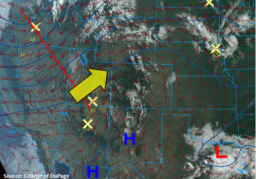
The trough to the northwest will start to move eastward today (red dashed line) causing flow aloft to become more southwesterly west of the Continental Divide (yellow arrow) and more westerly over eastern Colorado. This will entrain a very dry, hot air mass, which will mix out the mid-level moisture causing the morning cloud cover over the mountains. With large dew point depressions this afternoon (limited surface moisture), only weak, scattered storms are anticipated to form over the eastern mountains. Some extra mid-level energy from the trough will likely help kick off this high-based convection and allow the convection to survive as it moves off the mountains. If storms can stay intact, they should somewhat intensify as they make their way into the eastern plains and across the Raton Ridge where slightly better moisture will reside. Flooding is not expected from storms today, and gusty outflow winds will be the main threat due to the dry boundary layer. Over the far eastern plains and southern Raton Ridge, a couple stronger storms may produce some small hail, but severe storm chances are low.
Back to the west, relative humidity values are expected to drop fast with the hot, dry air moving overhead. Additionally, the passing trough will increase southwest surface to 10-20 mph (gusts up to 35 mph), so a Red Flag Warning has been issued for all of western Colorado and the mountains. A Red Flag Warning has also been issued for portions of the Northeast Plains and eastern Palmer Ridge with westerly surface winds anticipated to reach the 15 to 20 mph range and relative humidity dropping into the single digits. Please tune into your local NWS office for the latest on fire danger over your area.
Today’s Flood Threat Map
For more information on today’s flood threat, see the map below. If there is a threat, hover over the threat areas for more details, and click on burn areas to learn more about them. For Zone-Specific forecasts, scroll below the threat map.

Zone-Specific Forecasts:
Southeast Mountains, Front Range, Southeast Plains, Northeast Plains, Palmer Ridge, Raton Ridge, & Urban Corridor:
Expect high temperatures to be on the rise this afternoon with upper 90Fs forecast for the Urban Corridor and 100F over the eastern plains. High-based convection will kick off over the eastern mountains with the help of some mid-level energy. Expecting storms to produce more wind/cloud cover today than wetting rainfall; especially back west. The storms that can survive the dry environment, and make it into the eastern plains, will be capable of producing small hail and max 1-hour rain rates up to 0.75 inches. The best chance for storm survival looks to be along the southern Raton Ridge. Total rainfall up to 0.90 inches will be possible. Storm activity should end a couple hours after sundown as instability drops off.
Primetime: 1PM to 10PM
San Juan Mountains, Central Mountains, Northern Mountains, Northwest Slope, San Luis Valley, Grand Valley, & Southwest Slope:
It’s going to be dry and hot with Elevated fire danger this afternoon. A Red Flag Warning has been issued for all of these zones. High temperatures over the Grand Valley will flirt with the century mark, and highs over the mountain will reach the upper-70Fs to low 80Fs. Only broken cloud cover is forecast this afternoon near the Continental Divide, so be sure to keep yourself hydrated if you’re outside.