Issue Date: Monday, July 6th, 2020
Issue Time: 8:30AM MDT
—Flooding is NOT expected today
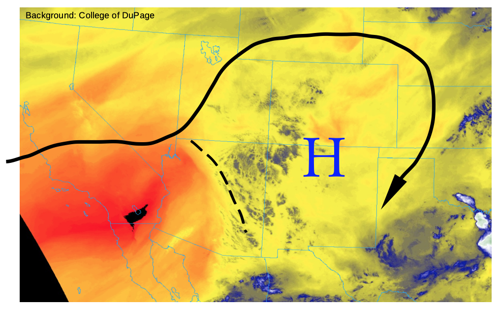
This morning’s water vapor image, below, shows that an upper-level ridge continues to hold its place over Colorado. However, it is not in top shape, as there is some monsoon-origin mid and upper-level moisture anchored to a weak mid-level disturbance making its way northeastward towards the Four Corners. This disturbance will provide mainly (welcome!) cloud cover and little rainfall this afternoon as the boundary layer has dried out over the past 24-48 hours. This morning’s PW at Grand Junction and Denver was 0.58 inches, below normal for this time of year. Thus, expect another slight downturn in this afternoon’s shower and thunderstorm coverage and intensity. The best coverage will be over the Central and Northern Mountains as well as the Palmer Ridge and Northeast Plains. However, flooding is not expected today.
With dewpoint temperatures falling below 20F this afternoon, an elevated wildfire threat will exist over most of western Colorado this afternoon. Check out the Twitter #COFire thread for updated fire information.
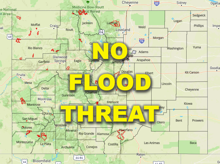
Today’s Flood Threat Map
For more information on today’s flood threat, see the map below. If there is a threat, hover over the threat areas for more details, and click on burn areas to learn more about them. For Zone-Specific forecasts, scroll below the threat map.
Zone-Specific Forecasts:
Northwest Slope, Grand Valley, Southwest Slope, San Luis Valley, San Juan Mountains:
Partly cloudy and very hot with isolated to widely scattered showers and thunderstorms possible this afternoon and evening. The best chances are in higher elevations above 8,000 feet. Maximum 1-hr rain rate up to 0.3 inches. Flooding is not expected today.
Northern Mountains, Central Mountains, Front Range, Urban Corridor, Palmer Ridge, Southeast Mountains, Raton Ridge, Southeast Plains, Northeast Plains:
Sunny early then partly cloudy and hot with widely scattered showers and thunderstorms this afternoon and evening. Maximum 1-hour rain rate up to 0.6 inches over eastern areas below 6,000 feet and 0.4 inches above 6,000 feet. Flooding is not expected today.