Issue Date: Thursday, July 2nd, 2020
Issue Time: 2:25PM MDT
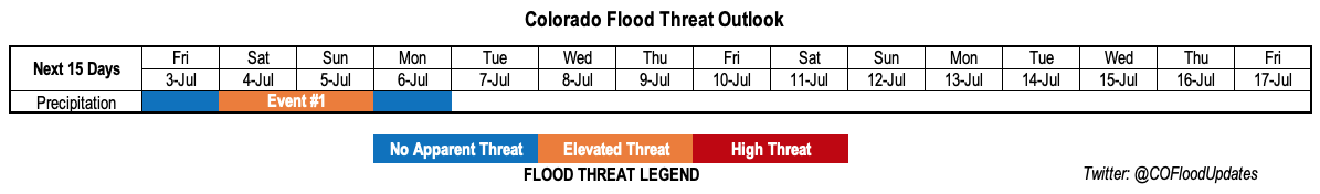
Valid Dates: 7/03 – 7/17
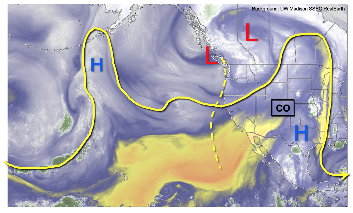
The afternoon’s water vapor imagery, below, shows an amplified pattern over the eastern Pacific Ocean and stretching into the central United States. Amplified patterns sometimes result in active weather, but such is absolutely not the case in this situation. A large ridge, currently centered just east of Colorado, will be almost stationary over the next 7-10 days, resulting in little to no movement of water vapor in or out of the state. Meanwhile, a large-scale trough over southwest Canada will attempt to usher in shortwave ripples in the flow. Ultimately, the ridge will remain in control, but not before a 72-96 hour event of increased precipitation chances mainly across central and eastern Colorado. This is the only precipitation event identified during this Independence Day Weekend-edition of the Outlook.
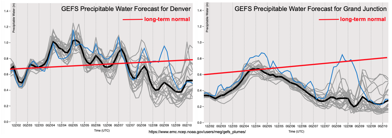
Looking at the PW plumes from the GFS ensemble shows a marked difference across the Continental Divide. While Denver will see a prolonged stretch of above normal moisture, Grand Junction will stay generally below normal. Thus, expect to see little to no precipitation below about 8,000 feet west of the Continental Divide, with precipitation limited to about 0.5 inches for the higher elevations of the San Juan Mountains and Central Mountains. The area likely to see the highest rainfall amounts will be across the far eastern and southeastern Colorado border. There, plenty of residual moisture will be trapped with PW up to 1.3 inches along the southern border with Kansas. Although synoptic scale support will be rather weak, there will be sufficient instability for a 48 hour stretch of isolated heavy rainfall, warranted an Elevated flood threat for the Saturday-Sunday timeframe. This is certainly good news given the recent upgrade to extreme drought status for parts of southeast Colorado.
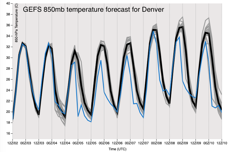
The aforementioned ridge is expected to take firm control of Colorado’s weather beginning Tuesday of next week (July 7th), as is clearly seen in the GFS ensemble forecast of 850 mb temperatures for Denver. Expect a 3+ day stretch of much above normal temperatures, reaching 100F even for elevations up to 5,500 feet. The prospects for widespread rainfall look very slim from Tuesday July 7th, onward. However, residual moisture could still produce higher terrain showers and storms depending on how much moisture is available in the boundary layer. However, at this time, precipitation amounts above 0.5 inches do not appear likely.
Event #1 is outlined in more detail.
Event #1: Friday (6/26) – Monday (6/29)
Elevated Threat on Saturday and Sunday with heavy rainfall possible along the Kansas border
Rainfall coverage will increase on Friday, with the highest coverage over the higher terrain as well as northeast Colorado where isolated severe storms will be possible. On Saturday and Sunday, the southeast quadrant of the state is expected to see the most activity, with one or two rounds of afternoon and evening showers and thunderstorms possible. Rainfall rates in the higher terrain are expected to stay at or below 0.5 inches so no flooding is anticipated, though the Decker and Spring Creek burn scars will need to be watched. Farther southeast, rainfall rates up to 2.4 inches per hour look to be possible across far southeast Colorado, as PW approaches 1.3 inches. Exact placement of storms will depend on mesoscale boundaries and the dryline position. Check back to daily Flood Threat Bulletins for updates.