Issue Date: Thursday, July 2nd, 2020
Issue Time: 9:45AM MDT
Summary:
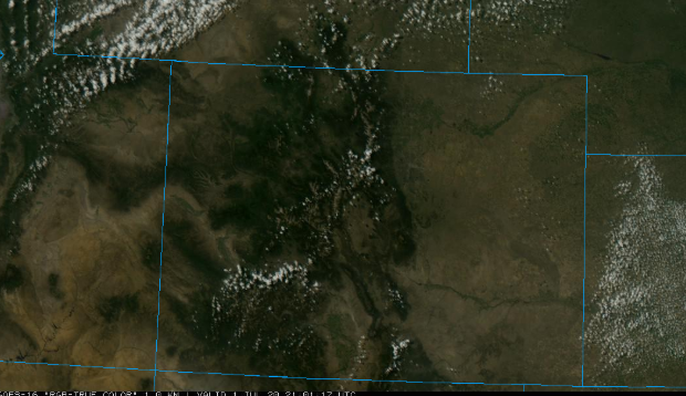
Absolutely gorgeous summer day on Wednesday as temperatures started to rise behind the trough. Below is the satellite imagery for the state at 3PM (source: College of DuPage) – crystal clear conditions with a few fair-weather cumulus over the mountains. Isolated storms may have produced trace amounts of rain (sprinkles, really), but the more likely scenario is just some cloud cover. Fog rolled into the easterly plains overnight with southeasterly surface flow increasing surface moisture. This moisture plume can be seen over Kansas working its way east below. Burlington reported ¼ mile visibility this morning around 5AM. The foggy conditions are continuing to improve with a little day time heating and mixing.
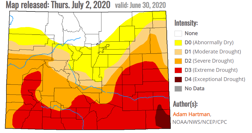
Below is the new drought map that came out this morning, and it is valid as of June 30 (Tuesday). This is the first map with D4 (Exceptional Drought) conditions, which are present over Baca County. The D4 category was last seen in February of 2019 after a dry WY 2018. Unfortunately, rainfall this afternoon will do little to help the worsening situation over the eastern plains. Baca County is about 3 – 3.75 inches below normal precipitation over the last 3 months. The D3 (Extreme Drought) area has also expanded over the Southeast Slope as well. Northern Colorado continues to remain the only area without drought conditions.
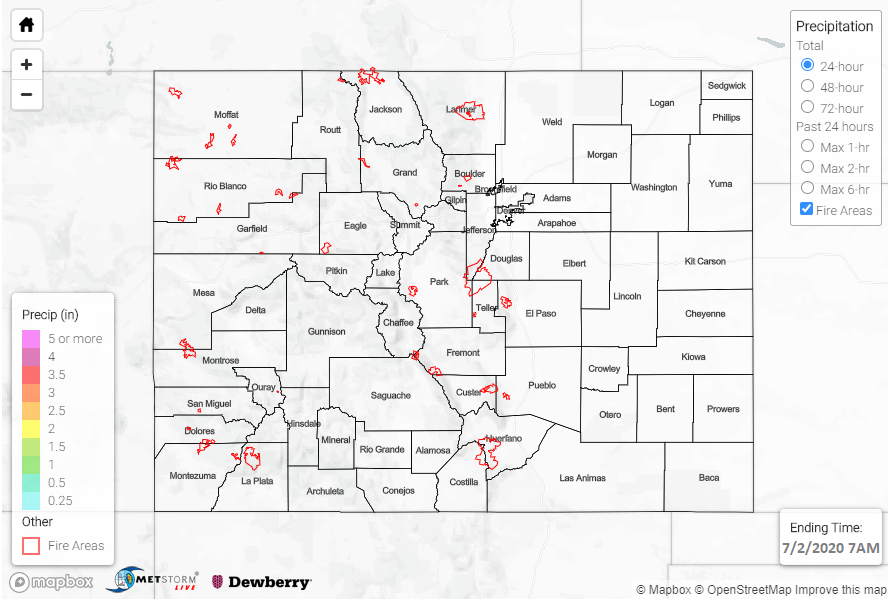
For precipitation estimates in your neighborhood over the last 72-hours, scroll down to the State Precipitation Map below.
Click Here For Map Overview
Note: The 24-hour, 48-hour and 72-hour total precipitation do not contain bias corrections today due to errors in the CoCoRaHS data. This means there may be underestimations in QPE over the southwest and southeast corners of the state.