Issue Date: Wednesday, July 1st, 2020
Issue Time: 9AM MDT
— Flooding is NOT expected today
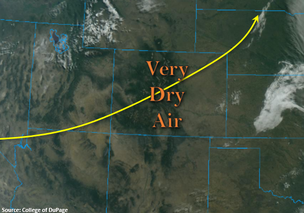
Very dry air has worked it way into the state, which can be seen by the cloud free conditions in the visible satellite imagery below. PW values have dropped to 0.58 inches over Denver and 0.31 inches over Grand Junction with both sounds showing very dry mid-levels. Therefore, rainfall is not forecast this afternoon, but still expecting an increase in cloud cover over the central and eastern mountains this evening. Overall, it should be a gorgeous day with high temperatures starting their rebound as the ridge builds in from the east. Additionally, there is less fire danger today with the jet to our north; however, stronger surface winds are still expected over the Northwest Slope and eastern Colorado. Tune into your local NWS office for the latest on Red Flag Warnings/critical fire weather.
Today’s Flood Threat Map
For more information on today’s flood threat, see the map below. If there is a threat, hover over the threat areas for more details, and click on burn areas to learn more about them. For Zone-Specific forecasts, scroll below the threat map.

Zone-Specific Forecasts:
Central Mountains, Northern Mountains, Northwest Slope, San Juan Mountains, San Luis Valley, Grand Valley, & Southwest Slope:
Highs today over the lower elevations should reach the upper 80Fs over the valleys with 70Fs for the slightly higher elevations and mountain valleys. So, the cool down was short-lived. A Red Flag Warning has been issued for portions of the Northwest Slope that will still be slightly under the influence of the trough to our north. Southwest surface winds between 10 and 20 mph are forecast with gusts up to 30 mph possible. Use extreme caution with anything that could cause a spark as fuels remain very dry. Rainfall is not forecast.
Front Range, Urban Corridor, Southeast Plains, Northeast Plains, Southeast Mountains, Raton Ridge, & Palmer Ridge:
High afternoon temperatures will also be on the uptick in these regions with the ridge building back over the state. Expect afternoon highs in the upper 80Fs and low 90Fs across the I-25 corridor with slightly higher temperatures for the eastern plains. In the mountains, 70Fs are forecast. Subsidence and dry air will keep rainfall chances away, but increasing cloud cover over the Front Range is likely this evening. A developing surface low over the Denver Metro area will increase surface winds by early this afternoon, so spotty, critical fire weather conditions are likely over the Palmer Ridge, Urban Corridor, and Northeast Plains. Flooding is not forecast.