Issue Date: Sunday, June 28th, 2020
Issue Time: 9:30AM MDT
Summary
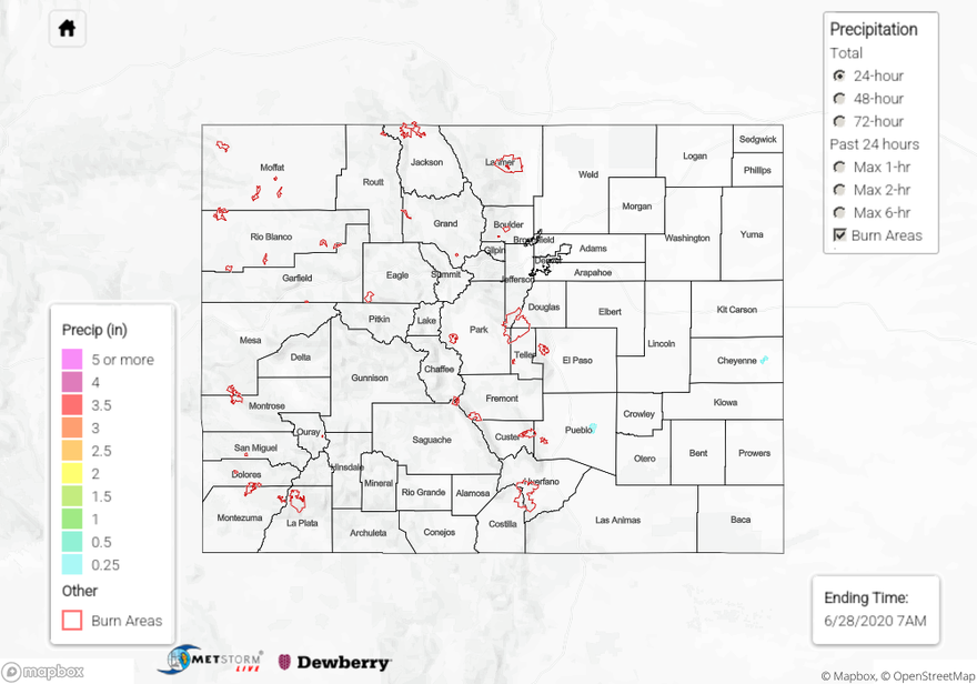
Shower and thunderstorms activity subsided sharply after Friday’s active day, as a disturbance moved east out of Colorado. However, some residual moisture and favorable dynamics support isolated to widely scattered activity mainly across the Palmer Ridge, Northeast Plains and Southeast Plains. Due to large dewpoint depressions (dry sub-cloud layer), it was once again difficult to estimate the highest rainfall. The highest rainfall amounts came from Yuma, Kit Carson and Cheyenne counties. This morning’s AHPS analysis suggested more than 1.5 inches of rain fell in an isolated stretch between Kirk and Idalia in Yuma county. On the one hand, this seems to be supported by an official report of 14 inches of floodwater in the vicinity of Idalia. On the other hand, of the three rain gages in the area of this rainfall, two from the CSU CoAgMet network and one from the RWIS network (all available through the University of Utah MesoWest data archive), the highest amount recorded at the three was less than 0.5 inches. This is supported by our official MetStormLive product shown below. The current thinking is that there was likely a very isolated region that measured a quick 0.5 to 1.0 inch of rain in less than 15 minutes, which resulted in a localized area of flooding where drainage was poor. Further substantiating this idea is the fact that there was almost no response in the nearby streamflow gauges on the North Fork and South Fork of the Republican River and a few nearby irrigation ditches (see the updated Colorado Department of Water Resources for a useful summary of near real-time streamflow data).
Elsewhere, isolated showers and thunderstorms produced generally less than 0.25 inches of rainfall leading to a warm and pleasant summer day.
For precipitation estimates in your neighborhood over the last 24 to 72-hours, scroll down to the State Precipitation Map below.
Click Here For Map Overview