Issue Date: 7/10/2015
Issue Time: 9:10AM
Summary:
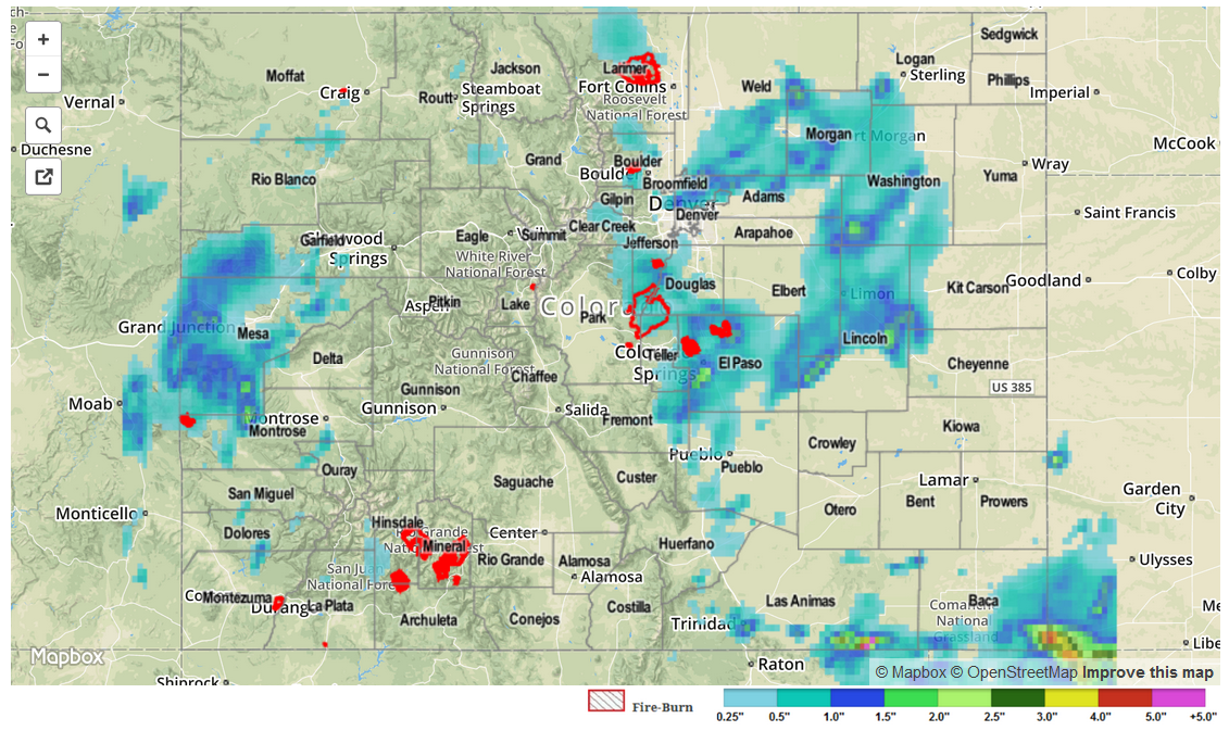
Ample moisture, slow storm movement and favorable dynamics conspired to produce quite an impressive heavy rain display yesterday. Storms started to form by early afternoon across the higher terrain of the San Juans, Central Mountains, Front Range and Raton Ridge. Within a couple of hours the storms moved eastward over the Plains, bringing them access to even higher moisture. By that point, there were many slow moving cells that were dumping very heavy rainfall. Rainfall amounts of 1 inch per 20 minutes were common over the Urban Corridor, Palmer Ridge and Raton Ridge. Here is a short summary:
- The most impressive storm of the day occurred in El Paso County (seems like a broken record this season!) where an observer near Falcon noted 3.01 inches of rain in 60 minutes, along with hail accumulating up to 4 inches deep. Many other locations picked up between 1 and 2 inches of rainfall in an hour. At least two flash flooding reports were received near the Colorado Springs area. However, it was likely that almost all area creeks and streams had a short burst of intense runoff that brought them near flood stage.
- Another heavy downpour was observed by the Urban Drainage and Flood Control District rain gage network. The gage southeast of Westminster recorded around 2.2 inches of rain in one hour. Amazingly, there was only one other gage in the vicinity that recorded over 1 inch per hour, reiterating how small-scale Colorado thunderstorms can be.
- Torrential rainfall was also seen across the Raton Ridge. Although the rain fell over mostly rural land, void of official reports, radar estimates suggest 2-3 inches of rain fell across isolated areas of both Las Animas and Baca Counties.
Observed 24-hour rainfall totals were highest near the Falcon storm where almost 4 inches of rain occurred! Meanwhile, a long list of counties received over 1 inch of rainfall, adding to the incredibly active summer that we have seen. In all, almost two dozen flood and severe weather warnings were issued by the National Weather Service offices covering Colorado.
For 24-hour rainfall amounts in your area, be sure to check out our radar estimated rainfall map below.