Issue Date: Saturday, June 20th, 2020
Issue Time: 9:00 AM MDT
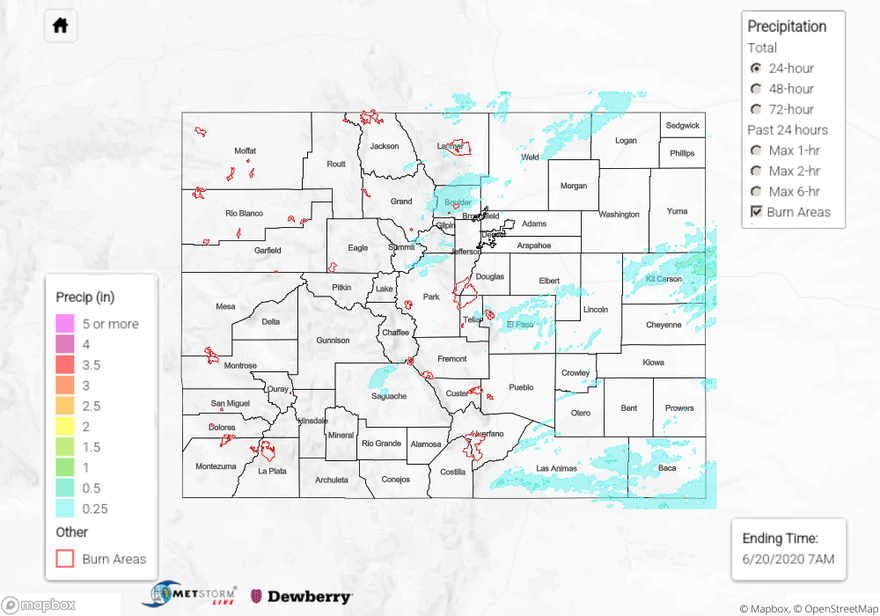
Summary:
It was another cool day across Colorado thanks to an upper-level disturbance swinging across the state. West of the Continental Divide, the disturbance provided enough support for scattered showers/weak thunderstorms. East of the Divide, enhanced moisture provided the fuel for widespread showers and thunderstorms; a few storms were strong, especially over the Southeastern Plains and Raton Mesa, where copious amounts of small hail were reported from one supercell in particular that rumbled along the NM/CO border. The only severe storm report coming from 7 miles North of Brandon (Kiowa County) where 1.75-inch diameter hail was reported. As far as rainfall reports are concerned, the following “top reports” come from CoCoRaHS observers (as of 7:15 AM):
0.74 inches: Las Animas County
0.59 inches: Weld County
0.50 inches: El Paso County
0.49 inches: Boulder County
0.43 inches: Kit Carson County
0.41 inches: Lincoln County
Flooding was not reported on Friday. For rainfall estimates in your area, check out our State Precipitation Map below.
Click Here For Map Overview