Issue Date: Thursday, June 18th, 2020
Issue Time: 2:30PM MDT
Valid Dates: 6/19 – 7/3
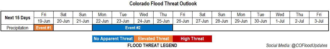
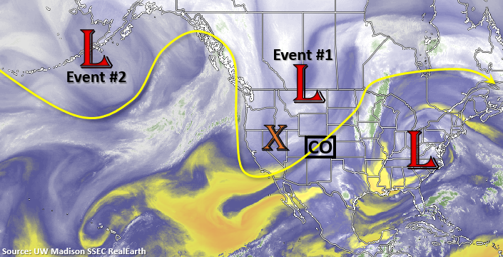
The main axis of the trough will move through Colorado on Friday, which will return afternoon and evening storms to eastern Colorado (Event #1). With upper level dynamics in place, a couple severe thunderstorms will be possible over the Southeast Plains with the main threats being severe hail and wind. Westerly flow aloft behind the trough quickly dries out the lower levels heading this weekend, so expect a downtick in storm activity. Monday, Event #2 begins as another cold front slides south during the late afternoon/evening and returns low-level moisture. Rainfall is possible both along and behind the front this time with storm activity increasing on Tuesday in a post-frontal upslope flow environment. Wednesday and Thursday, another ridge begins to build overhead. A developing High over the southwest US will help reinforce this moisture under the ridge and may pull a little subtropical moisture northward into the state. As the trough passes to the north (Event #2 Low), increased mid-level lift is also anticipated. This will help to keep afternoon storms in the forecast through the end of the week. Storms will likely stay in the forecast through next weekend, but it’s a little far out to add anything to this heavy rainfall outlook.
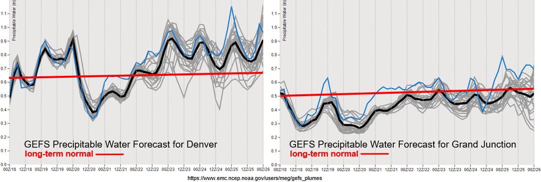
The PW images below are from last night’s run, so use caution when looking at the timeline. Behind the front, PW values start to increase (today), but the moisture is quickly scoured out over western Colorado. Winds are also forecast to pick up over southwest Colorado tomorrow afternoon as the trough moves through, so paired with the dry atmosphere, critical fire weather is likely. Moisture looks to remain a little higher throughout next week and with no strong systems moving through, more relaxed surface winds are anticipated. This should bring a break in critical fire weather.
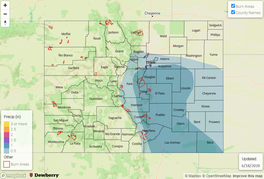
Over eastern Colorado, PW is expected to either stay the same or slightly increase tomorrow, which will help produce another round storms. Instability looks to be a little greater as well, which should help create a couple severe thunderstorms over the Southeast Plains. PW values in this area are forecast near an inch (not shown), so heavy rainfall is likely as the storms move off the eastern mountains into the I-25 corridor with the westerly steering flow. Thus, there is an Elevated flood threat issued.
Event #1: Friday (6/19)
Elevated Threat as moisture increases over the Southeast Plains.
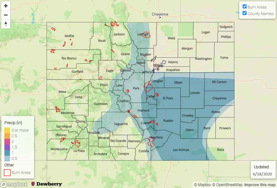
Storms are expected to return to the eastern mountains on Friday with upslope flow initiating the convection. With mid-level energy also present, storm are expected to be a little more widespread and intense than today. Rainfall will likely develop over the Front Range and northern Southeast Mountains by noon, and stronger thunderstorms will develop where the sun can break through. As storms move off the mountains with the more westerly steering flow, they will likely increase in intensity due to higher instability and more moisture. Further south, (south of the Palmer Ridge) heavy rainfall will be possible with the stronger storms that develop, and max 1-hour rain rates just over 1 inch will be possible. Also forecasting increased totals along the Raton Ridge with the increased convergence over the area. Recent burn areas over the Southeast Mountains will also be under the gun for the heavy rainfall threat, and the highest threat will likely be over the Decker burn area.
Event #2: Monday – Thursday (6/22 – 6/25)
No Apparent Threat as moisture returns behind another cold front and gets trapped under the building ridge.
Moving up this next event from Monday’s FTO. Rain looks to return to the forecast by Monday afternoon/evening behind and along another cold front. Low-level moisture is increased for post-frontal upslope flow on Tuesday. It doesn’t look to have too big of a heavy rainfall threat yet, but if the jet stays to the north east of Colorado, steering flows will decrease and allow storms to drop more rainfall. Details like this will continue to be watched over the weekend. Wednesday and Thursday, storms will likely form over the higher terrains each afternoon with residual moisture under the ridge. The reformation of the subtropical high might also help reinforce low-level moisture over eastern Colorado. It looks to stay stormy heading into next weekend, but more on that in Monday’s FTO.