Issue Date: Tuesday, June 16th, 2020
Issue Time: 9AM MDT
— Flooding is NOT expected today
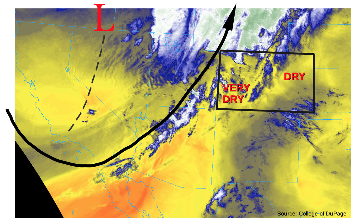
This morning’s water vapor imagery, shown below, shows a rather strong upper-level trough approaching Colorado. Unfortunately, as described in yesterday’s Flood Threat Outlook, it has a very limited amount of moisture to work with as it moves eastward. Precipitable water (PW) at Grand Junction this morning was a meager 0.20 inches, with Denver at 0.42 inches. Even across eastern Colorado, PW was well below 1.0 inch. Thus, expect mainly diurnally driven clouds across the central and southern higher terrain, with isolated showers and storms limited to the Southeast Mountains, Raton Ridge and Southeast Plains this afternoon. Gusty winds will be the biggest threat with any storm that does develop and flooding is not expected today. It will also be very hot statewide, but especially east of the Continental Divide. This morning’s 700mb temperature (about 5,000 ft above ground level) from the Denver sounding was 61F, which is close to a record for mid-June. Thus, expect high temperatures to be 10-15F above normal.
By far the bigger story today will be the threat of wildfires. A Red Flag warning has been issued for the almost the entire state, save for a small portion of north-central Colorado. Afternoon sustained winds of 20-25 mph are likely, with much higher gusts especially over the Northwest Slope. To stay updated on the latest fire conditions, check out local National Weather Service forecasts and discussion, and the #COfire thread on Twitter.
Today’s Flood Threat Map
For more information on today’s flood threat, see the map below. If there is a threat, hover over the threat areas for more details, and click on burn areas to learn more about them. For Zone-Specific forecasts, scroll below the threat map.

Zone-Specific Forecasts:
Northeast Plains, Front Range, Palmer Ridge, Urban Corridor:
Mostly sunny early then partly cloudy during the afternoon. Windy and very hot with lower elevations approaching 100F (below 4,500 feet). Parts of the area are under a Red Flag warning for the threat of wildfires.
Flooding is not expected today.
Central Mountains, Northwest Slope, Grand Valley, Northwest Slope, Southwest Slope, San Juan Mountains, San Luis Valley:
Partly cloudy, hot and very windy today. Afternoon wind gusts exceeding 50mph are likely across northeast facing slopes. A Red Flag warning is in effect today for the threat of wildfires.
Flooding is not expected today.
Southeast Mountains, Raton Ridge, Southeast Plains:
Mostly sunny early then partly cloudy during the afternoon. Isolated showers and thunderstorms are possible. Max 1-hour rainfall up to 0.5 inches, mainly across eastern areas. Otherwise, windy and very hot with lower elevations approaching 100-105F. Parts of the area are under a Red Flag warning for the threat of wildfires.
Flooding is not expected today.