Issue Date: Sunday, June 14th, 2020
Issue Time: 9:20AM MDT
Summary:
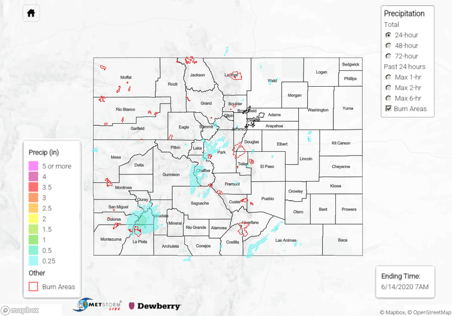
Yesterday was the peak of this current event as dynamics and moisture combined to help return storms to the mountains and adjacent plains. There wasn’t a whole lot of moisture with this system, but trailing storms helped increase the storm totals in terms of precipitation. The most widespread rainfall, and highest 24-hour totals, were over the San Juan Mountains. A Low flood threat was issued for the 416 burn area, and there was a report of 0.18 inches in 10-minutes along with pea sized hail in Hesperus around 6PM. Radar estimates up to 0.50 inches of rain fell near the burn area, and observations in the area are as high as 0.75 inches (CoCoRaHS) for the 24-hour period. Thankfully, the more gradual rainfall allowed flooding issues to be avoided over the burn area. As storms moved into the adjacent plains and lower elevations, their rain rates tended to decrease and winds increase. However, a couple totals estimated by radar, neared 0.50 inches along the western Raton Ridge. Makes sense considering the moisture surge from the south. The afternoon cloud cover also felt nice as hot temperatures were present once again. There was also some wind reported yesterday with gusts reported in the 45 to 55 mph range over western Colorado and up to 67 mph over eastern Colorado (Cheraw). No damage was reported as of this morning.
For precipitation estimates in your area over the last 24 to 72-hours, scroll down to the State Precipitation Map below. Please note there are some issues with yesterday’s QPE, so please ignore the values over northern Lincoln County and Alamosa County under the 48-hour rainfall totals.
Click Here For Map Overview