Issue Date: Saturday, June 13th, 2020
Issue Time: 10:05AM MDT
Summary:
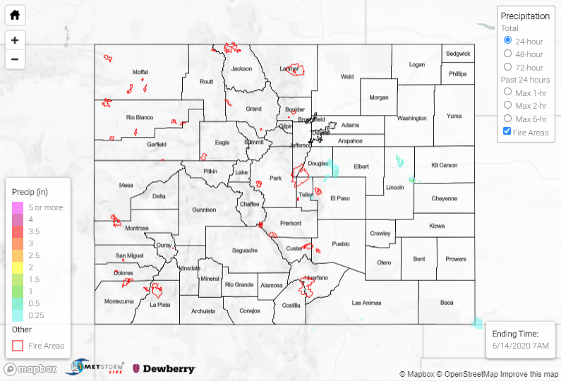
Temperatures went a few degrees up yesterday with max highs reaching the upper 90Fs over the Southeast Plains and Grand Valley. Grand Junction was just 1F shy of its daily 100F record! As far as rainfall, a little subtropical moisture made its way across the southern border. A few storms popped over the southern high terrains and Raton/Palmer Ridge by early afternoon. The dry boundary layer to the west kept measurable rainfall limited. Radar estimations indicate that the highest peaks of the San Juans reached up to 0.15 inches of rainfall. Over the Raton Ridge area, isolated rain totals up to 0.50 inches were estimated with most storms only producing 0.25 inches. The strongest storm of the day was over the Palmer Ridge (Douglas County) around 7PM. Around 0.75 inches of rain was estimated in its core with a CoCoRaHS station recording 0.46 inches of precipitation in Franktown. That’s very impressive as the evening sounding at Denver Airport showed PW values just over a half of an inch. It is likely that some mid-level energy was moving through the flow during this time frame, which helped enhance the storm’s lift. Activity ended a couple hours after the sun set with no lifting mechanism to keep them lingering overnight.
For precipitation estimates in your area over the last 24 to 72-hours, scroll down to the State Precipitation Map below. Note that the high QPE values over eastern and northern Lincoln County are over estimations.
Click Here For Map Overview
Note: The 24-hour, 48-hour and 72-hour total precipitation do not contain bias corrections today due to errors in the CoCoRaHS data. This means there may be underestimations in QPE over the southwest and southeast corners of the state.
