Issue Date: Friday, June 12th, 2020
Issue Time: 9:45AM MDT
Summary:
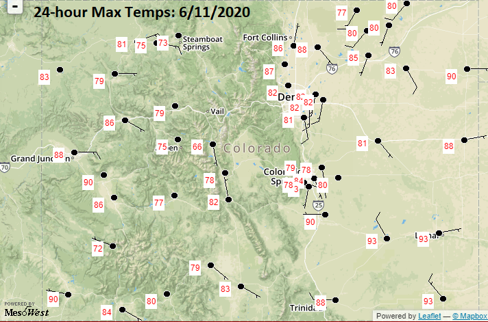
It was another quiet weather day yesterday with the ridge building overhead, little to no moisture, and subsidence (sinking motion) over the state. Other than some afternoon cloud cover, it was the perfect summer day. Very hot temperatures were just to our west where several gages came within a couple degrees of the daily record highs. Rainfall was not recorded at any gages, but radar indicated some light precipitation may have fallen over eastern El Paso County.
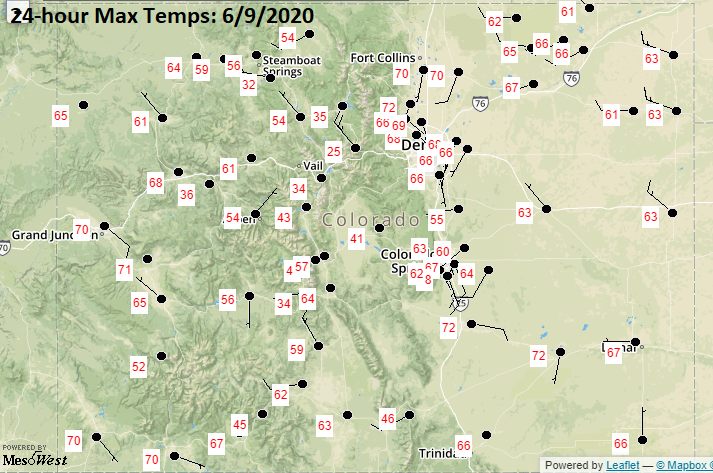
Below are the high temperatures from Thursday afternoon (source: MesoWest). That’s quite the rebound from Tuesday, which is shown below yesterday’s highs. DIA went from 68F to 82F, and other areas across the state also saw this 15-20F temperature swing. The most impressive area to look at is the eastern plains. This area received rainfall most of the day, so temperatures were not able to warm much.
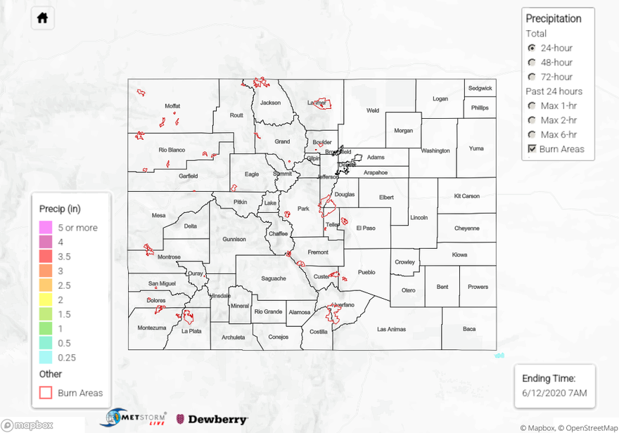
For precipitation estimates in your area over the last 72-hours, scroll down to the State Precipitation Map below.
Click Here For Map Overview