Issue Date: Thursday, June 11th, 2020
Issue Time: 1:30PM MDT
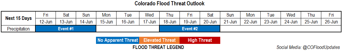
Valid Dates: 6/12 – 6/26
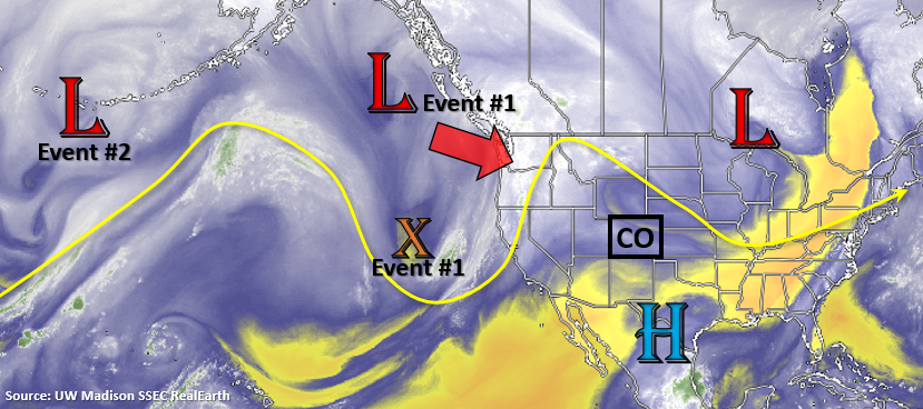
Two events are identified for this FTO, with Event #1 beginning tomorrow. Over the last couple of days, a ridge has been building over the Great Basin to our west. This has returned sunshine, warmer temperatures, and a quieter weather pattern after a stormy start to the week. The vorticity maximum (orange “X”) and Low will combine over the Pacific Northwest on Saturday (Event #1) and start to move to the northeast through this weekend. By Sunday/Monday the second Low pressure system slides into the Gulf of Alaska from the west, which will place Colorado under weak, dry southwesterly flow to start the work week. Expecting hot temperatures to return for Event #1 despite the increase in storminess.
It then becomes a bit unclear as to what will happen with models varying from one another and run to run. However, there will likely be an increased chance for rainfall sometime at the end of next week (Thursday to Saturday time frame) as the next system moves inland, becomes an open wave, and releases its mid-level energy (Event #2). There does not look to be a lot of moisture associated with this system, as of now, so there is No Apparent Flood threat issued.
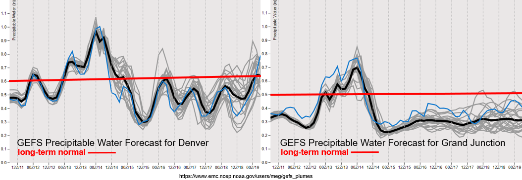
Taking a look at the PW plumes below, there’s a nice northward surge of moisture as the ridge is displaced eastward for Event #1 both east and west of Colorado. PW reaches around 1 inch over Denver and up to 0.70 inches over western Colorado. While rain is expected to return to the southern high terrains on Friday, the intensity and coverage of precipitation will peak for Event #1 on Saturday over the high terrains and Urban Corridor/Palmer Ridge.
PW rapidly drops off on Sunday west of the Divide, and the GEFS is also showing southwest surface winds increasing during this period. This means that there may be some fire weather concerns for the western slope on Sunday afternoon. Next week, the jet stream looks to remain mostly northwest of the state, but it may dip into the northwest corner. Thus, there may be some critical fire weather for that region with PW dropping below 0.30 inches.
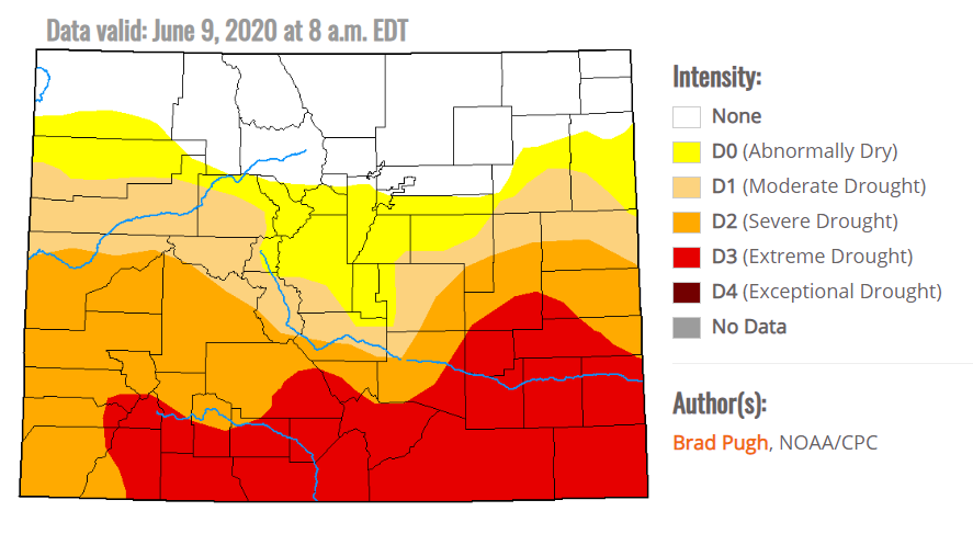
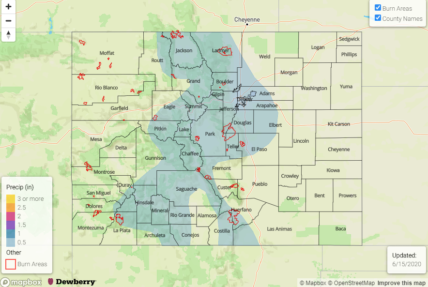
Lastly, the D3 drought area has been expanded to cover almost all of southern Colorado, while up north remains drought free. Despite receiving rainfall over the Southeast Plains on Tuesday, it was not nearly enough to make any impact. Looking forward to that monsoon moisture shift as I’m sure these areas are getting quite crispy.
Event #1: Friday – Sunday (6/12 – 6/14)
No Apparent Threat as next trough moves into the Pacific Northwest and moves to the northeast.
As mentioned above, storms are first expected to increase across the southern high terrains on Friday. By Saturday, better moisture and upper dynamics will be in place, so there will likely be an increase in afternoon storms intensity and coverage over the high terrains. The southwest flow should keep the storms moving, so at this time there is No Apparent flood threat. Some small hail and gusty winds may be possible with CAPE values around 1000 J/kg over western Colorado. Storms that form over the Front Range will likely spill into the adjacent plains (Urban Corridor and Palmer Ridge) with the southwest steering flow, but likely won’t survive into the far eastern plains with storm motion. As quickly as the moisture returns, it is expected to mix out. Thus, there will be a large downtick in afternoon storm activity by Sunday.
Event #2: Thursday – Saturday (6/18 – 6/20)
No Apparent Threat as next trough passes north of Colorado, but there is low confidence in this events’ details.
Don’t want to give this event too much time as the models and runs are all showing drastically different patterns by the end of the week. Some models are producing little to no precipitation, while others are showing more widespread storminess with all models indicating different timing. Right now, not thinking that there will be a large moisture return for the event, and of three days mentioned, likely only one will have meaningful precipitation. A map has not be drawn for these reasons and that precipitation could easily remain under 0.50 inches. We will keep an eye on this for the next couple FTOs, and confidence in the forecast will likely increase towards the end of next week.