Issue Date: Wednesday, June 10th, 2020
Issue Time: 10AM MDT
Summary:
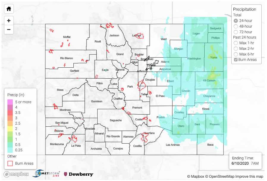
The strong low pressure system moved into the eastern plains yesterday morning bringing rainfall from late morning into the early evening. Without much instability being able to build, storms produced beneficial rainfall rather than server weather. Upper dynamical support and higher moisture allowed for some decent totals. Kit Carson and Yuma Counties were the winners over the Northeast Plains with totals between 1 and 1.5 inches. A CoCoRaHS station north of Burlington recorded 1.5 inches with others in the area recording 1.22 and 1.37 inches. Generally, totals were estimated between 0.5 and 0.75 inches.
Over the Southeast Plains, rainfall wasn’t quite as widespread, although there were pockets up to 0.75 inches of rain in Otero and Prowers Counties. A USGS gauge near Houghton recorded 0.56 inches. This may have helped alleviate some of the drought over the area, although over the last 30 days precipitation over most of the Southeast Plains was between 1 and 2 inches below normal. Gusts reached 83 mph in Cheyenne County just after 11AM with sustained winds in the 40-50 mph range over the same area. No doubt this probably caused some power outage issues in the area.
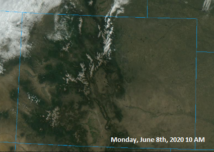
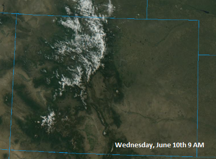
Some fun satellite images below show the before and after the snow storm. I had to wait until this morning to grab the comparison as it was pretty cloudy yesterday. The images from College of DuPage are definitely showing an enhancement of the snow pack. I really like the difference over Pikes Peak and Blanca Peak.
For precipitation estimates in your area over the last 24 to 48-hours, scroll down to the State Precipitation Map below.
Click Here For Map Overview