SPM 06-04-2020: Severe Thunderstorms for the Eastern Plains

Issue Date: Thursday, June 4th, 2020
Issue Time: 9:40AM MDT

Summary:

For the most part, storms were high-based yesterday and produced little rainfall. A stronger storm over Fremont County produced a wind gust of 62 mph, which means it was likely outflow driven with only brief rainfall. Radar and nearby CoCoRaHS showed 0.50 inches of rainfall. Further east along a dryline, storms were able to produce more rainfall and some hail. Hail up to 1.75 inches in diameter was reported in Yuma County, and storms in the area produced (up to) 50 mph outflow boundary gusts. It’s a rural and very ungauged area, but radar estimated up to 0.75 inches of rain in the cores of the severe thunderstorms. Flooding was not reported on Wednesday.

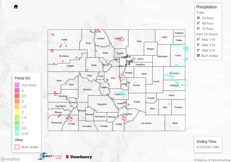
For precipitation estimates in your area over the last 72-hours, scroll down to the State Precipitation Map below.

Click Here For Map Overview

The map below shows radar-estimated, rainfall gage-adjusted Quantitative Precipitation Estimates (QPE) across Colorado. The map is updated daily during the operational season (May 1 – Sep 30) by 11AM. The following six layers are currently available: 24-hour, 48-hour and 72-hour total precipitation, as well as maximum 1-hour, 2-hour and 6-hour precipitation over the past 24 hour period (to estimate where flash flooding may have occurred). The 24-hour, 48-hour and 72-hour total precipitation contain bias corrections that are not disaggregated into the hourly estimates, so there will likely be some differences. The accumulation ending time is 7AM of the date shown in the bottom right corner. Also shown optionally are vulnerable fire burn areas (post 2012), which are updated throughout the season to include new, vulnerable burn areas. The home button in the top left corner resets the map to the original zoom.