Issue Date: Thursday, June 4th, 2020
Issue Time: 9:15AM MDT
— Flooding is NOT expected today
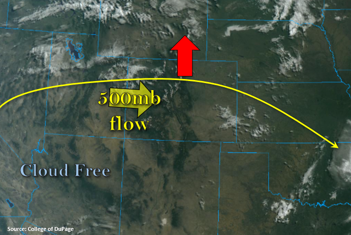
Beautiful start to the morning with a few clouds over the state. There are some clouds lingering over the Southeast Plains from overnight convection, but these should clear up rather quickly with the daytime heating. The Northwest Slope also has cloud cover, which is associated with ripples moving through the zonal flow to our north. Expecting the ridge shown below to build northwards today (red arrow), which means another round of hot afternoon temperatures. Flow aloft will turn more westerly as this happens, which will continue to pull in the dry air mass from our west and southwest. This will mix out a good majority of the remaining surface moisture trapped under the ridge.
The result – a continued downturn in afternoon convection as dew points drop. Westerly flow across the state will place the dry line well into Kansas/Nebraska, so severe storms over the eastern plains are not probable this afternoon. High-based storms are still anticipated to form over the mountains with upslope flow, and the best chance for a little rainfall will be over the Northern, Central and northern Front Range Mountains near the Divide. Additional scattered storms will likely form over the elevated regions of the Palmer and Raton Ridges. Once again, the main threat from storms will be brief, gusty winds. This is especially true as storms move off the mountains, with the westerly flow, and become outflow driven. As anticipated, flooding is not forecast.
Today’s Flood Threat Map
For more information on today’s flood threat, see the map below. If there is a threat, hover over the threat areas for more details, and click on burn areas to learn more about them. For Zone-Specific forecasts, scroll below the threat map.

Zone-Specific Forecasts:
Front Range, Southeast Mountains, Northern Mountains, Central Mountains, Raton Ridge, Palmer Ridge, Urban Corridor, Southeast Plains, Northeast Plains, & San Luis Valley:
Best chances for storms will be over the northern high terrains with higher accumulations (west) along the Divide. Max 1-hour rain rates up to 0.20 inches will be possible. Storms over the adjacent plains may produce pockets of totals up to 0.25 inches, but many storms will just provide cloud cover from the heat and a couple sprinkles. Flooding is not forecast, and storms are expected to decrease in coverage a couple hours after the sun sets.
Primetime: 2:30PM to 9:30PM
San Juan Mountains, Northwest Slope, Grand Valley, & Southwest Slope:
A couple storms may fire over the elevated areas of these regions this afternoon with best coverage further north where lift and moisture is a little better. For the most part, cumulus will produce virga and brief, windy conditions. Rainfall amounts should remain well below 0.10 inches. Hot temperatures are forecast once again with a slight increase from yesterday.
Primetime: 1:30PM to 8PM