Issue Date: Wednesday, June 3rd, 2020
Issue Time: 10:15AM MDT
Summary:
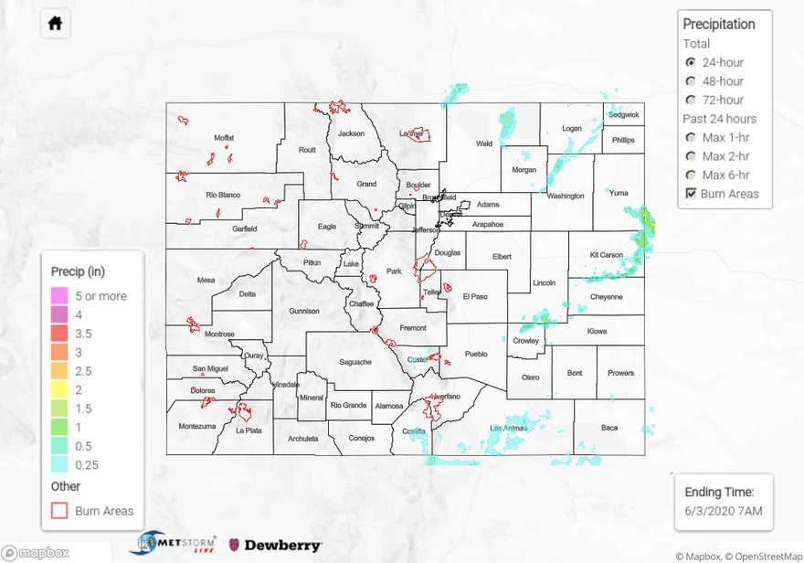
The drying trend began yesterday with the high located to our south and westerly/northwesterly flow aloft. This caused a downtick in afternoon storms activity over the mountains with little to no activity west of the Continental Divide. Totals over the eastern mountains were typically under 0.10 inches with the southern Southeast Mountains receiving around 0.25 inches. As storms moved east, moisture increased a little, so totals increased to about 0.50-0.75 inches. A Severe Thunderstorm Warning was issued for Weld County during the evening.
Higher moisture was located over the eastern plains where a convergence boundary was located (weak “cold” front). Nearly stationary storms in the late afternoon/evening produced some very high totals, landspouts, and flash flooding over Kit Carson and Cheyenne Counties. A strong outflow gust south of Burlington caused a mini dust storm with zero visibility. Over 2 inches of rain fell in 30 minutes between Goodland and Burlington along the border! Not surprising that a Flash Flood Warning was issued for these storms.
For precipitation estimates in your area over the last 24- to 72-hours, scroll down to the State Precipitation Map below.
Click Here For Map Overview