Issue Date: Tuesday, June 2, 2020
Issue Time: 10:40AM MDT
Summary:
Very hot temperatures continued across Colorado on Monday, fittingly the first day of meteorological summer. Noteworthy high temperatures included:
99F at La Junta (4,200 ft)
97F at Fort Morgan (4,500 ft)
92F at Denver International Airport (5,400 ft)
81F at Steamboat Springs (6,900 ft)
86F at Alamosa (7,600 ft)
72F at Leadville (9,900 ft)
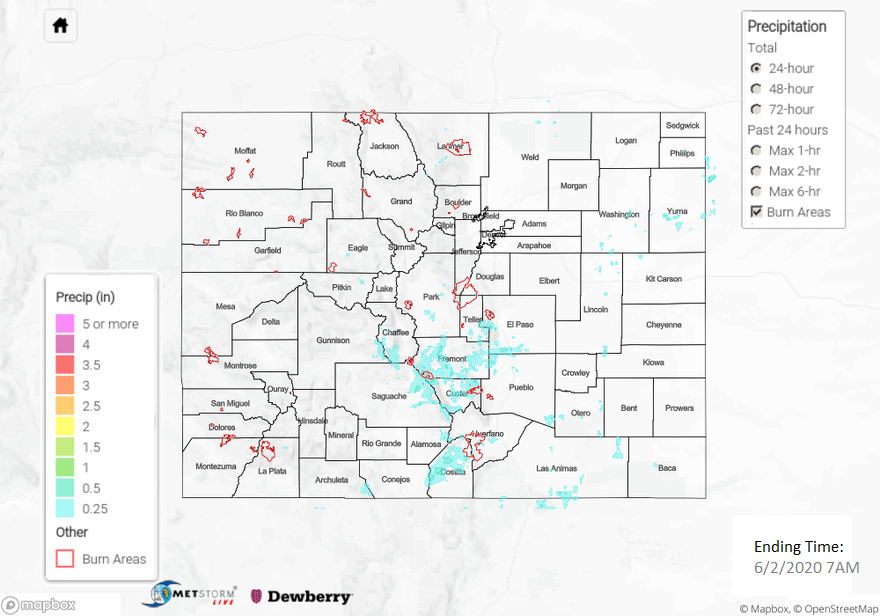
Along with the heat came above average moisture, by early June standards, leading to scattered afternoon showers and thunderstorms mainly across southern areas. The highest observed rainfall came in at 1.05 inches from near Fort Garland in the San Luis Valley. This is extremely unusual for this time of year, as that area typically does not see heavier rainfall until the monsoon season. More common were amounts in the 0.25-0.50 inch range. These amounts are usually not enough to warrant flooding, unless of course they fall over fire burns. Indeed, there were two such NWS products issued. First, a Flash Flood Warning was issued for the Hayden Pass burn scar around 2:40PM. Second, a Small Stream Flood Advisory was issued for the High Park burn scar in Larimer County around 4:55PM. Fortunately, neither location reported any flooding, but we are reminded how sensitive these areas can be due to a lack of vegetation and a hygroscopic top layer that can efficiently repel water.
For precipitation estimates in your neighborhood over the last 72-hours, scroll down to the State Precipitation Map below.
Click Here For Map Overview