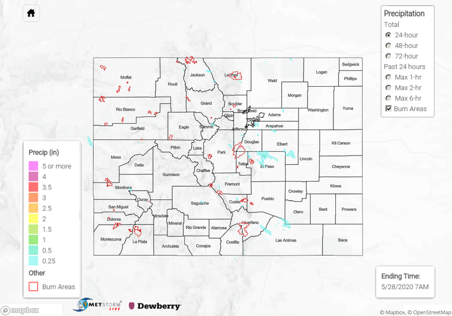
Issue Date: Thursday, May 28th, 2020
Issue Time: 9:55AM MDT
Summary:
Storms returned to the forecast as an approaching shortwave from our northeast moved into the area during the afternoon. This helped increase both lift and moisture. Storms were mostly confined to the mountains with the more northerly flow, but some storms moved into the adjacent eastern plains. Over the mountains, storm totals were estimated as high as 0.25 inches (west) and 0.50 inches (east). Trailing storms helped increase totals as 1-hour rain rates were below these values. There were also some gusty outflow winds over western Colorado reported by ASOS stations. As storms moved off the eastern mountains, they favored the Raton and Palmer Ridge for accumulations. A storm in El Paso County produced up to 0.75 inches (radar estimated) with a CoCoRaHS in the are recording between 0.50 and 0.55 inches. There were also a couple light overnight showers on the eastern plains, but totals were under 0.20 inches. Flooding was not reported on Wednesday.
For precipitation estimates in your neighborhood over the last 24-hours, scroll down to the State Precipitation Map below.
Click Here For Map Overview
