Issue Date: Friday, May 15th, 2020
Issue Time: 9:50AM MDT
Summary:
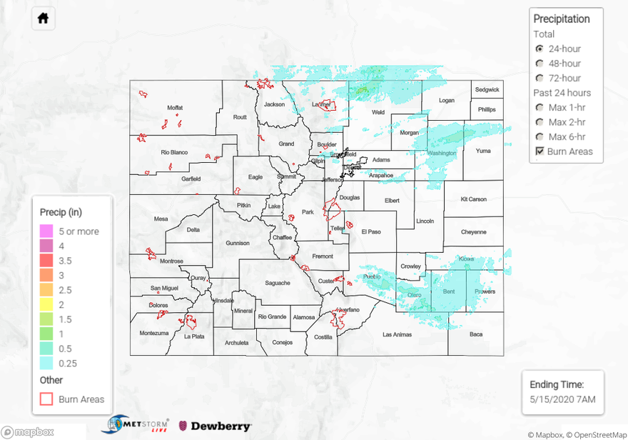
Showers and thunderstorms returned to the forecast yesterday over the northern border and eastern plains as there were a slight increase in moisture and lift with the passing trough to our north. As storms initially rolled off the mountain into the plains, a lot of the low-level moisture had mixed out so there was more brief windy conditions and clouds than measurable rainfall. The ALERT system picked up around 0.25 inches for the storm that moved through Coal Creek Canyon. Around 1PM, 0.88 inch hail was reported with a storm that moved through Berthoud. Between yesterday’s morning and afternoon rainfall in Weld County, 24-hour totals tallied around 1 inch. Overnight storms on the Southeast Plains produced the highest 24-hour values, and rainfall was estimated at over an inch. A CoCoRaHS station north of La Junta reported 1.42 inches of rain, which is very much needed in this region due to the worsening drought. Flooding was not reported on Thursday.
For precipitation estimates in your region yesterday, scroll down to the State Precipitation Map below.
Click Here For Map Overview