Issue Date: Monday, May 11th, 2020
Issue Time: 2:45PM MDT
Valid Dates: 5/12 – 5/26

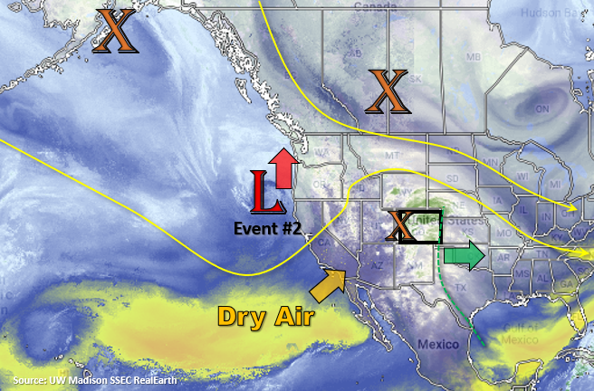
Seen in the water vapor imagery below a nice northward surge of subtropical moisture. This and the shortwave over western/central Colorado are responsible for today and tonight’s precipitation. Not a lot of complaints here as this moisture is very much needed, and the cooler temperatures have been nice change of pace. Some lingering moisture over eastern Colorado and a fast-moving shortwave (lift) will conclude Event #1 tomorrow with isolated afternoon storms forecast. Westerly flow aloft will push the highest moisture (green dashed line) east of the state, so there is No Apparent flood threat.
Flow aloft behind the current shortwave quickly turns southwesterly and begins to advect a dry air mass across the state. This has already prompted a Red Flag Warning for the lower elevations of the Grand Valley and Southwest Slope tomorrow afternoon. A Fire Weather Watch has been issued for the San Luis Valley for Tuesday afternoon as well. Expecting fire danger to remain elevated for these regions through Thursday with a peak and more widespread fire weather on Wednesday for the state.
Event #2 begins on Thursday as the lobe of vorticity over Canada passes to our north and flattens the ridge. A cold front overnight on Wednesday will help return moisture to eastern Colorado for storms on Thursday afternoon. Following this system is the Low off the California coast, which will pass to our north Friday into Saturday. Another passing cold front at this time will keep the low-level moisture in place over northern and eastern Colorado. Additionally, a jet over the northern Colorado boarder will help provide lift for some stronger, more widespread storm activity on Friday. A couple severe storms will be possible over the eastern plains on Thursday and Friday. It will begin to dry out and heat up following this weekend as a strong Low sets up off the coast of California and produces southwest flow, so fire danger is expected to escalate once again.
Streamflow over northern and central Colorado will start to increase next week with the warm up. At this time there isn’t any flooding anticipated, and overall large-scale flooding concerns are low this season. Further south, not expecting much more in terms of streamflow increases due to a large majority of the snow pack already being melted and dry soils (less runoff). Both will help keep the threat of riverine flooding very low this season over these regions.

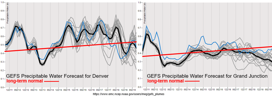
Huge drop off in moisture behind today’s system over western Colorado (right). Hence the uptick in fire danger over the next couple days with increased surface winds forecast. This dry air works into eastern by tomorrow night with the westerly flow, and both areas are below normal when compared to climatology. The passing systems later this week return surface moisture, and therefore storm chances, to eastern Colorado. Western Colorado will remain drier during this same period, although the northern mountains and Northwest Slope may see some light rainfall due to its proximity to the passing systems. Overall, PW values are well under an inch across the majority of the state, so not expecting flooding issues at this time. PW values over the far eastern plains will be watched closely, but at this time they don’t seem to rise much above an inch.

Event #1: Tuesday (5/12)
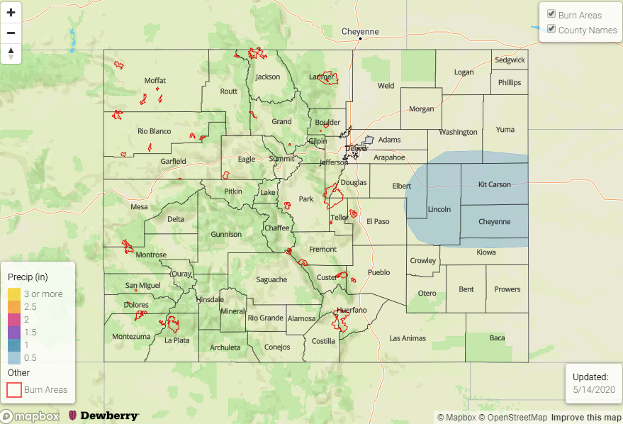
No Apparent Threat as lingering moisture provides a chance for scattered afternoon showers over the eastern plains.
A surface low over the eastern plains will help create some convergence for isolated, afternoon storms on its southeast side. For the most part, expecting these storms be high-based, with more wind than heavy rainfall. A couple of the storms could be severe with the main threat being 1-inch hail and gusty outflow winds. With their quick pace westward, there is No Apparent threat for flooding. The most likely area for accumulation is over the eastern Palmer Ridge and Baca County at this time. Tune into the FTB tomorrow for more details.
Event #2: Thursday (5/14) – Saturday (5/16)
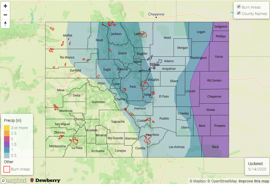
No Apparent Threat as multiple shortwave pass north of the state and break down the ridging pattern.
An active pattern is forecast for the end of this week with flow becoming more zonal aloft. This zonal pattern will allow for a couple cold fronts to move through the state, which will help return afternoon storms to the forecast for northern and eastern Colorado by increasing low-level moisture. At this time, the strongest storms are forecast for Friday afternoon and evening with the passage of a cold front over the eastern plains. Of course, the front will have to pass through during the period of maximum instability (late afternoon/evening). Details will likely evolve, so be sure to tune back in on Thursday for an update. The main threats for severe storms on Thursday and Friday will be hail, dangerous lightning and strong winds gusts due to the high storm bases. With storm motion increasing Thursday into Friday, due to the jet being overhead, and higher moisture values to our east, flooding is not forecast.