Issue Date: Wednesday, May 6th, 2020
Issue Time: 8:50AM MDT
Summary:
High temperatures were on the rise Tuesday with the building ridge overhead. The max 24-hour temperature can be seen at the NWS ASOS locations below (MesoWest). Warmest temperatures were over the lower elevations of southern Colorado, and it was also quite warm in the Grand Valley. Not much in the way of rainfall again yesterday. There were a couple rounds of weak showers over the Raton Ridge and adjacent Southeast Plains. Overall, totals were below 0.10 inches, so not much help to the increasing drought situation down there. More on that in Thursday’s FTO.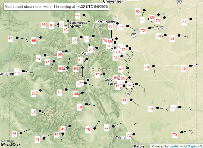
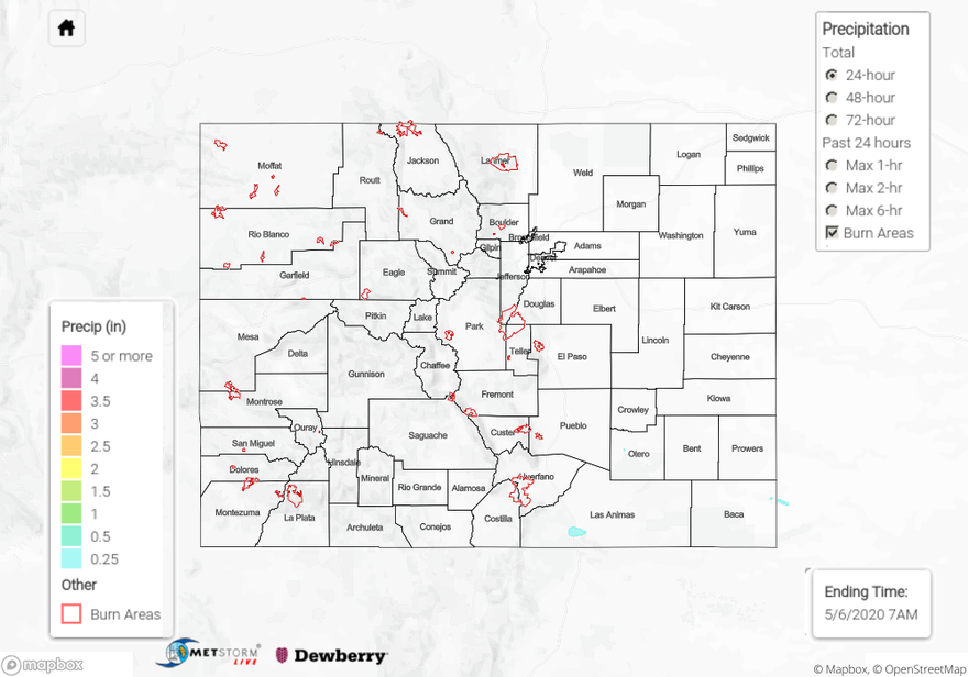
For precipitation estimates in your surrounding neighborhood yesterday, scroll down to the State Precipitation Map below.
Click Here For Map Overview
The map below shows radar-estimated, rainfall gage-adjusted Quantitative Precipitation Estimates (QPE) across Colorado. The map is updated daily during the operational season (May 1 – Sep 30) by 11AM. The following six layers are currently available: 24-hour, 48-hour and 72-hour total precipitation, as well as maximum 1-hour, 2-hour and 6-hour precipitation over the past 24 hour period (to estimate where flash flooding may have occurred). The 24-hour, 48-hour and 72-hour total precipitation contain bias corrections that are not disaggregated into the hourly estimates, so there will likely be some differences. The accumulation ending time is 7AM of the date shown in the bottom right corner. Also shown optionally are vulnerable fire burn areas (post 2012), which are updated throughout the season to include new, vulnerable burn areas. The home button in the top left corner resets the map to the original zoom.