Issue Date: Wednesday, May 6th, 2020
Issue Time: 8:25AM MDT
— Flooding is NOT expected today
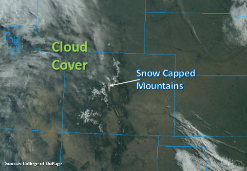
Another cold start with the warmest overnight temperatures noted in the Southeast Plains and Grand Valley (mid 40Fs). The visible satellite imagery below is showing broken cloud cover over the Northwest Slope this morning. The axis of the upper level ridge will be overhead today, which will start to flatten out into this evening. So, the two main weather stories today with be an increase high temperatures statewide and escalating westerly surface winds over western and south, central Colorado. With relative humidity forecast to drop into the single digits as well over western Colorado, a Red Flag Warning has been issued from noon to 9PM this evening. This includes the Grand Valley, Southwest Slope, San Luis Valley and northern Central Mountains. A surface low moves in from the north this evening, which may help cool off temperatures overnight. However, this tightening pressure gradient, with no moisture associated with it, is anticipated to keep critical fire weather in the forecast for tomorrow.
Over eastern Colorado, surface winds are forecast be more mild from the southeast as a surface low moves south from Wyoming. Paired with slightly higher relative humidity, this should keep critical fire conditions from being met. Without much low level moisture, just looking at some afternoon cloud cover again. Expecting clouds to form over the mountains during the early afternoon and push into the adjacent plains with the northwest flow aloft.
Today’s Flood Threat Map
For more information on today’s flood threat, see the map below. If there is a threat, hover over the threat areas for more details, and click on burn areas to learn more about them. For Zone-Specific forecasts, scroll below the threat map.
Zone-Specific Forecasts:
Northwest Slope, Grand Valley, Southwest Slope, San Luis Valley, Central Mountains & San Juan Mountains:
An increase in westerly surface winds is forecast this afternoon. Paired with warm temperatures, dry fuels and low relative humidity, a Red Flag Warning has been issued from noon to 9PM. Winds will be in the 10 to 25 mph range with gusts up to 35 mph possible. Be sure to use extreme caution the next few days with anything that can produce a spark, and tune into your local NWS office for the most up to date information.
Northern Mountains, Front Range, Palmer Ridge, Urban Corridor, Northeast Plains, Raton Ridge, Southeast Mountains & Southeast Plains:
High temperatures are forecast to be in the mid-70Fs for the lower elevations and 60Fs for the mountain valleys. No rainfall is anticipated this afternoon, but cloud cover should increase throughout the day. Critical fire weather is anticipated for tomorrow, so be sure to tune back in to the FTB.