Issue Date: Monday, May 4th, 2020
Issue Time: 9:55AM MDT
Summary:
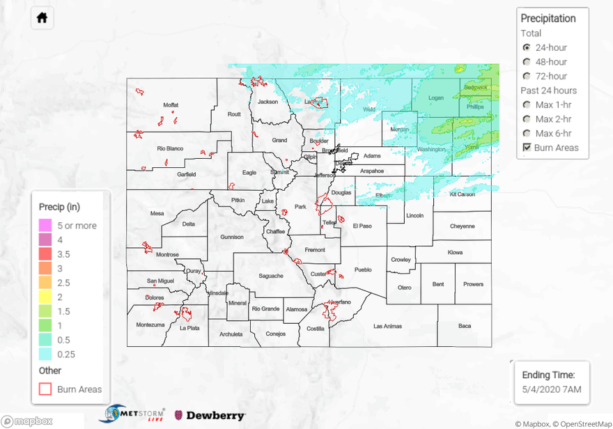
Rinse and repeat pattern with additional overnight thunderstorms on Sunday into Monday. More moisture and CAPE available in the atmosphere allowed for some stronger thunderstorms. Isolated storms first fired over the Northeast Plains and Palmer Ridge in the late afternoon. Hail up to 1 inch in diameter was reported on a Severe Thunderstorm in Elbert County. Rainfall totals for the 24-hour period were estimated at just under 2 inches in the area. More widespread and multiple rounds of thunderstorms developed around 9PM through this morning for the Palmer Ridge and Northeast Plains. A 1.75 inch diameter hail stone was reported at 11PM in Sterling, CO associated with a severe thunderstorm. 24-hour totals were just under 2 inches in northern Yuma, Phillips and Sedgwick Counties. No flooding was reported, and this was definitely a nice wetting rain for the crops.
Out west, strong winds were reported again in Northwest Colorado. Two 50 mph wind reports came out of Garfield and Meeker Airports around 2PM yesterday afternoon. The Wyman fire continues to burn in southwest Routt County (18 miles SW of Hayden) and is currently 380 acres. Hazy conditions may be experienced in Pagoda, Hayden and Craig although winds picking up from the northwest may help disperse the smoke away.
For precipitation estimates in your neighborhood on Sunday, scroll down to the State Precipitation Map below.
Click Here For Map Overview
