Issue Date: Saturday, July 4th, 2015
Issue Time: 9:00 AM MDT
Summary:
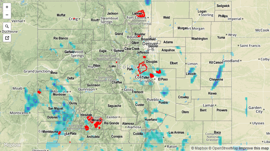
Widely scattered thunderstorms dotted the state yesterday, producing mainly lightning, small hail, and strong winds. A few storms were able to really tap into the available moisture and instability, producing periods of very heavy rain. One complex of storms, in particular, produced very heavy rain across the Pikes Peak region; a trained spotter reported that 1.06 inches fell in 40 minutes, 4 miles NNE of Colorado Springs. That’s equivalent to a 1.59 inches/hour rain rate. Even more impressive, a trained spotter 5 miles NW of Peterson AFB reported 0.79 inches of rain in 20 minutes, or 2.37 inches/hour.
As far as severe storm reports are concerned, the following were reported to local NWS offices:
7 miles ENE of Virginia Dale (Larimer County): 1.5 inch hail
4 miles S of the Air Force Academy (El Paso County): 1.0 inch hail
Urban street flooding occurred in Colorado Springs, but no other flash flooding was reported. Be sure and check out the radar-derived Storm Total Precipitation map below for a statewide overview of yesterday’s rainfall.