Issue Date: Friday, September 27th, 2019
Issue Time: 10:10AM MDT
Summary:
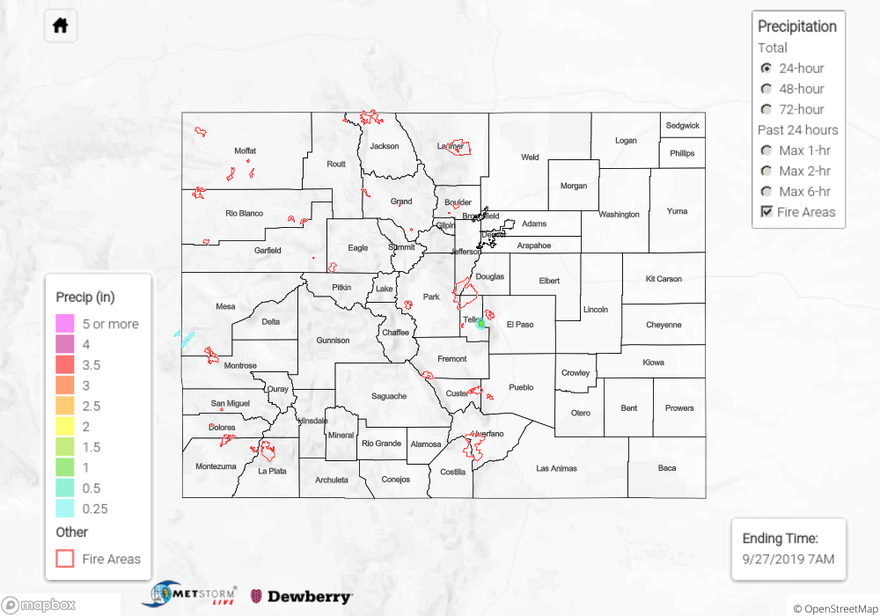
Quite the dry air mass overhead yesterday with dew points mostly in the in the 30°Fs over western Colorado and 20°Fs over portions of the Central and eastern mountains. There were a couple pockets where dew points reached the low 40°Fs over the western border, which allowed some weak thunderstorms and rainfall to occur. Elsewhere, there was just an increase in cloud cover. Montezuma County saw a little rain, which is very much needed. CoCoRaHS in and around Cortez recorded around 0.15 inches. Storms produced an outflow gust of 33 mph around 5:30PM at the County Airport (KCEZ). Light rain also fell in northwest Montrose County and southwest Mesa County. Totals were slightly higher in the 0.25-0.30 inch range.
Wind gusts over northern Colorado (focused over the Northwest Slope) were the other weather story of the day. Gusts around 35 to 40 mph created dangerous fire conditions with RH in the teens. There were no new fires to report in this area as of this morning. The Hunt Fire in Rio Blanco County is 40% contained and has burned ~3,800 acres (last update Sep 15th). The Middle Man fire has burned about 275 acres. The most dangerous fire continues to the Decker Fire 9 miles south of Salida. It has burned 1,300 acres and has 118 personnel continuing to try to corral the fire. It has predominately burned within the Wilderness boundary, but is burning in an area with a lot of beetle kill (high-risk fuel).
To see estimated precipitation totals over your neighborhood the last couple of days, scroll down to the State Precipitation Map below. Note the bullseye over El Paso County just west of Colorado Springs is an error.
Click Here For Map Overview