Issue Date: Thursday, September 26th, 2019
Issue Time: 9:20AM MDT
— Flooding is NOT expected today
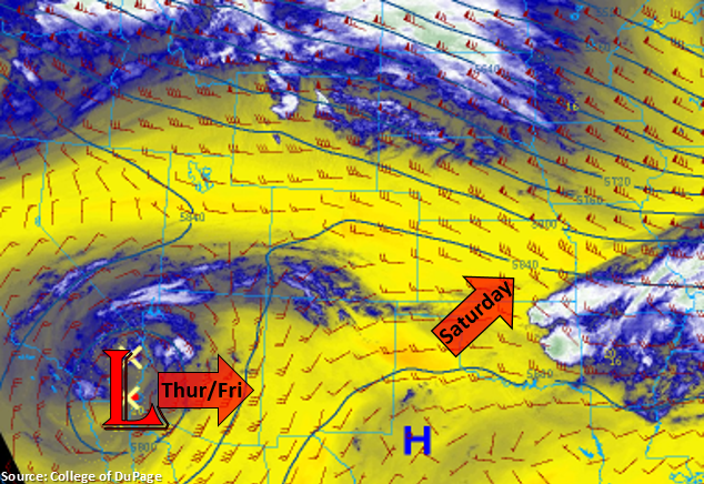
The cut off low that has been sitting over southern CA/AZ becomes an open wave today as the next trough starts to dig south over the Pacific Northwest. This will release some mid-level energy and push slightly higher PW values northward. So forecasting isolated to scattered showers to return to the Central and San Juan Mountains later this afternoon and evening. Over Grand Junction, PW increases 0.3 inches to put it around 0.7 inches by late this afternoon. While this moisture return will allow for light accumulation (high-based storms), back building storms could help slightly increase totals. The high-based storms are also expected to produce some gusty outflow winds. Rainfall may continue overnight in the Central Mountains and along the Continental Divide as a cold front starts to drop south. Additionally, Critical Fire weather returns to the Northwest Slope and Northern Mountains this afternoon as moisture won’t reach that far north. The increase in winds is due to the tightening gradient from the approaching trough. Southwest surface winds in the 20 to 30 mph range with gusts between 40 and 50 mph can be expected. A Red Flag Warning has been issued from noon to 8PM tonight.
There is a slight moisture return for eastern Colorado as well, so this may allow a weak shower or two to form over the southern Front Range/Palmer Ridge this afternoon. Rather than wetting rainfall, the more likely scenario is just an increase in cloud cover due to the lack of moisture and fast storm motion to the east. Elevated fire danger is expected over the northern Front Range, which includes the foothills and mountain valleys. Flooding is not forecast for Thursday.
Today’s Flood Threat Map
For more information on today’s flood threat, see the map below. For Zone-Specific forecasts, scroll below the map.
Zone-Specific Forecasts:
San Juan Mountains, Northern Mountains, Northwest Slope, Grand Valley, Central Mountains, Southwest Slope, San Luis Valley:
Best chance for rainfall accumulation will be over the higher terrains of the San Juan and Central Mountains favoring the southwest facing slopes. Storms will likely produce gusty outflow winds as well. Max 1-hour rain rates up to 0.5 inches will be possible over the San Juan Mountains with max 1-hour rates decreasing to 0.25 inches over the Central Mountains. Very isolated storm totals up to 0.7 inches will be possible over the San Juans with up to 0.5 inches possible over the Central Mountains. Due to the later nature of the rainfall (decrease in instability = gradual rainfall), flooding is not forecast.
Primetime: 4PM to 11PM
Front Range, Urban Corridor, Palmer Ridge, Northeast Plains, Southeast Mountains, Raton Ridge, Southeast Plain:
Best chance for an isolated afternoon storms will be over the Front Range and Palmer Ridge. With fast westerly steering flows, and only minimal increases in low level moisture, max storm totals should remain under 0.1 inches. Virga may allow for some brief, gusty outflow winds. Strong surface winds can be expected over the Northern Front Range with gusts up to 50 mph possible with the tightening pressure gradient. Flooding is not forecast.
Primetime: 4PM to 9PM