Issue Date: Thursday, July 2nd, 2015
Issue Time: 9:00 AM MDT
Summary:
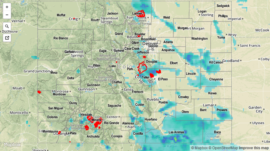
Upper-level high pressure remained anchored across the western United States, allowing moisture to stream into Colorado. Precipitable water values climbed to near, or above, 1 inch at all of the 4 usual reporting sites. With moisture that deep, rainfall was produced efficiently by thunderstorms. Showers and thunderstorms began first over the mountains, moving southeast with time, and made their way over the plains during the afternoon and evening hours. A few flood advisories were issued, but no flash flooding has been reported.
The big rainfall “winners” according to CoCoRaHS observers were the following:
Kit Carson County: 1.22 inches
Teller County: 1.09 inches
Lincoln County: 0.88 inches
Weld County: 0.76 inches
Be sure and check out the radar-derived Storm Total Precipitation map below for a statewide overview of yesterday’s rainfall.