Issue Date: Thursday, September 5th, 2019
Issue Time: 10:40AM MDT
Summary:
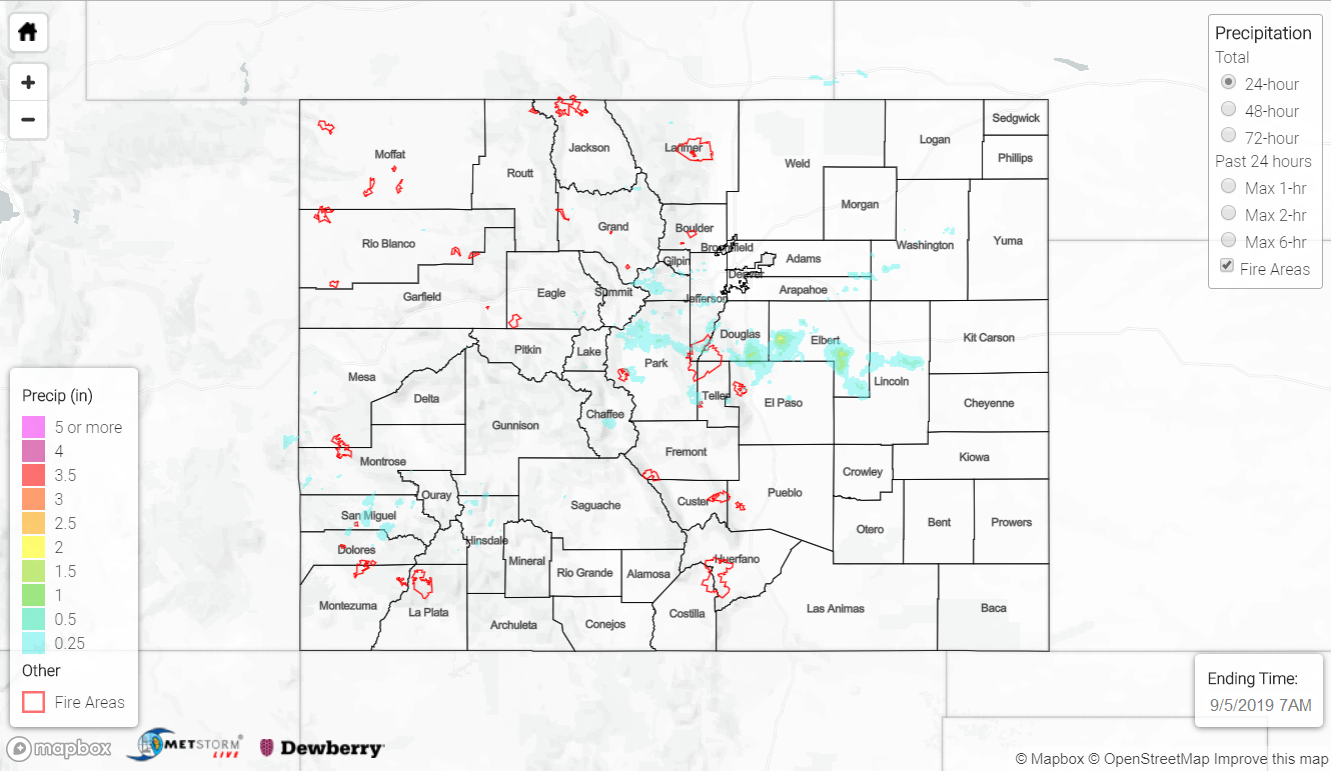
Afternoon storm coverage increased over the high country yesterday as a shortwave embedded within the high pressure ridge made its way over the state from the west. Lower levels of moisture near the surface over the higher elevations kept surface accumulation on the lighter side for the western mountain ranges. Rainfall increased towards the Continental Divide where there was a better moisture pool from the previous day’s rainfall and cold front on Tuesday. Chaffee County had the highest surface measurements for the mountains yesterday reporting between 0.12 and 0.42 inches over the area. Radar derived just above 0.25 inches over the San Juan Mountains and Southwest Slope with 0.23 inches measured by a COOP station over Red Mountain Pass.
Over the Front Range, cumulus began to sprout around 11am and storms moved into the adjacent plains around noon with the westerly flow aloft. The strongest storm formed near Colorado Springs and moved east over the Palmer Ridge with the upper level flow. Enhanced convergence over the elevated terrain and better moisture allowed storms to produce higher rain rates. Localized heavy rain was reported to the north of Monument in El Paso County with 0.9 inches of rain falling in 30 minutes. Mesonets throughout northern El Paso County and southern Douglas County reported as much as 0.98 inches with most totals between 0.20 and 0.45 inches of rain. Radar derived isolated 1-hour rainfall rates up to 1.33 inches and 1.18 inches over western and eastern Elbert County, respectively.
Outflow boundaries helped regenerate the storms as they moved east, but a stronger cap over the far eastern border counties caused the storms to dissipate and produce some gusty winds before they could reach the Kansas border. Wind gusts up to 35 mph were reported near Seibert in western Cheyenne County, which produced a dust storm that limited visibility to a quarter mile during the evening hours. The Limon airport had southerly winds in the 15 to 20 mph range yesterday afternoon and a strong outflow boundary from a thunderstorm moving through around 6PM. A gust of 50mph was recorded at the airport, so I’m sure this helped produce the dust storm as it moved east.
To see estimated precipitation totals over your neighborhood on Wednesday, scroll down to the State Precipitation Map below.
Click Here For Map Overview
Note: The 24-hour, 48-hour and 72-hour total precipitation do not contain bias corrections today due to errors in the CoCoRaHS data. This means there may be underestimations in QPE over the southwest and southeast corners of the state.