Issue Date: Tuesday, September 3rd, 2019
Issue Time: 10:20AM MDT
Summary:
It was a scorcher out there yesterday with another day of record breaking heat recorded statewide for the Labor Day holiday. Shown below is a map of the large dome of high pressure (500 mb height contour) over the four corners region, which is anomalously strong for this time of year. Thus, it’s not surprising several areas under the ridge had record breaking or near record breaking heat. The map below shows those heat records with a legend in the bottom left corner describing what they represent. Areas of northern Colorado and the eastern plains broke the heat record for the month of September (pink circles) along with numerous tying daily high records over the state (orange circles). A couple of the pink circles were monthly records that were re-broken from Sunday. The highest temperature recorded yesterday was over the Southeast Plains where it measured 106°F at Lamar Municipal Airport. Highs reached into the 100°Fs over the Grand Valley, Urban Corridor, Northeast Plains and Southeast Plains.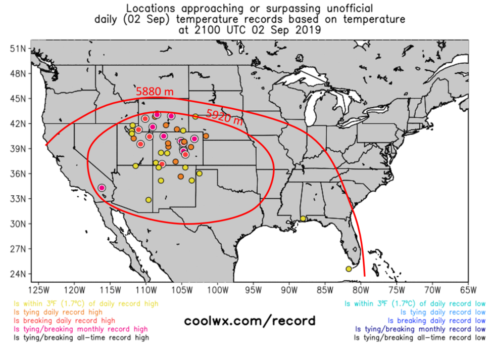
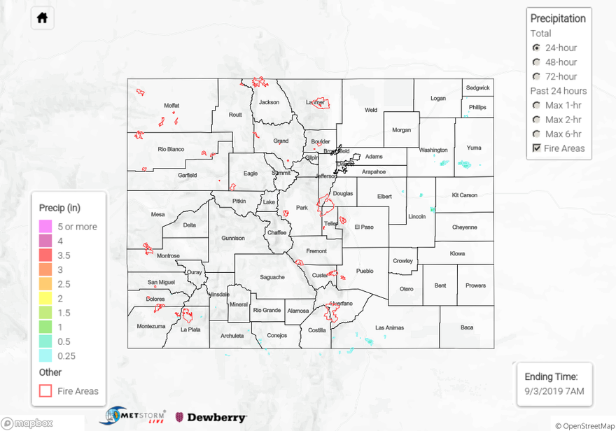
As far as precipitation goes most of the state remained dry with relative humidity dropping into the teens and single digits. Mid-level moisture within westerly flow lead to some light but persistent high based showers over the high elevations of the San Juan Mountains. A few thunderstorms also popped up over the eastern Palmer Ridge and Raton Ridge just after noon and moved over the adjacent plains a little later in the afternoon. Surface measurements of rainfall remained very low with the highest 24-hour total measured by a CoCoRaHS station in southwestern Yuma County of 0.09 inches. Radar derived isolated totals just over 0.5 inches in Las Animas, Yuma and Washington Counties. Note, the total over 1 inch in eastern Lincoln County is not accurate.
For a look at rainfall over your area, please visit the State Precipitation Map below which does not contain the bias correction today. Note that the 72-hour total will not be available until tomorrow due to an outage over the weekend.
Click Here For Map Overview
Note: The 24-hour, 48-hour and 72-hour total precipitation do not contain bias corrections today due to errors in the CoCoRaHS data. This means there may be underestimations in QPE over the southwest and southeast corners of the state.