Issue Date: Sunday, September 1st, 2019
Issue Time: 9:10 AM MDT
Summary:
Strengthening upper-level high pressure over the region brought plenty of sunshine and above average high temperatures to Colorado yesterday. However, with the hot temperatures, enough instability was generated to produce a couple of isolated thunderstorms during the afternoon and evening over the Cheyenne Ridge, Raton Ridge, Front Range, and Southeast Mountains. Cloud-to-ground lightning, brief periods of light-to-moderate rainfall, and gusty winds were the main impacts. Two thunderstorms of note produced large hail: the isolated storm that tracked across Larimer and Weld counties produced 1.50-inch diameter hail (4 miles west of Carr), and the isolated thunderstorm over El Paso County produced 1.00-inch diameter hail (1 mile ESE of Ellicott).
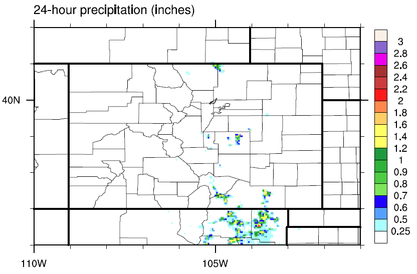
No flash flooding was reported yesterday. For a look at precipitation estimates in your area, please see the State Precipitation Map below.
NOTE: Due to issues with our mapping service that are beyond our control, the SPM map today will be a static image. If we are able to resolve this issue, it will be updated with the correct zoom-able map.
Click Here For Map Overview
The map below shows radar-estimated, rainfall gage-adjusted Quantitative Precipitation Estimates (QPE) across Colorado. The map is updated daily during the operational season (May 1 – Sep 30) by 11AM. The following six layers are currently available: 24-hour, 48-hour and 72-hour total precipitation, as well as maximum 1-hour, 2-hour and 6-hour precipitation over the past 24 hour period (to estimate where flash flooding may have occurred). The 24-hour, 48-hour and 72-hour total precipitation contain bias corrections that are not disaggregated into the hourly estimates, so there will likely be some differences. The accumulation ending time is 7AM of the date shown in the bottom right corner. Also shown optionally are vulnerable fire burn areas (post 2012), which are updated throughout the season to include new, vulnerable burn areas. The home button in the top left corner resets the map to the original zoom.