Issue Date: Saturday, August 31st, 2019
Issue Time: 9:10 AM MDT
Summary:
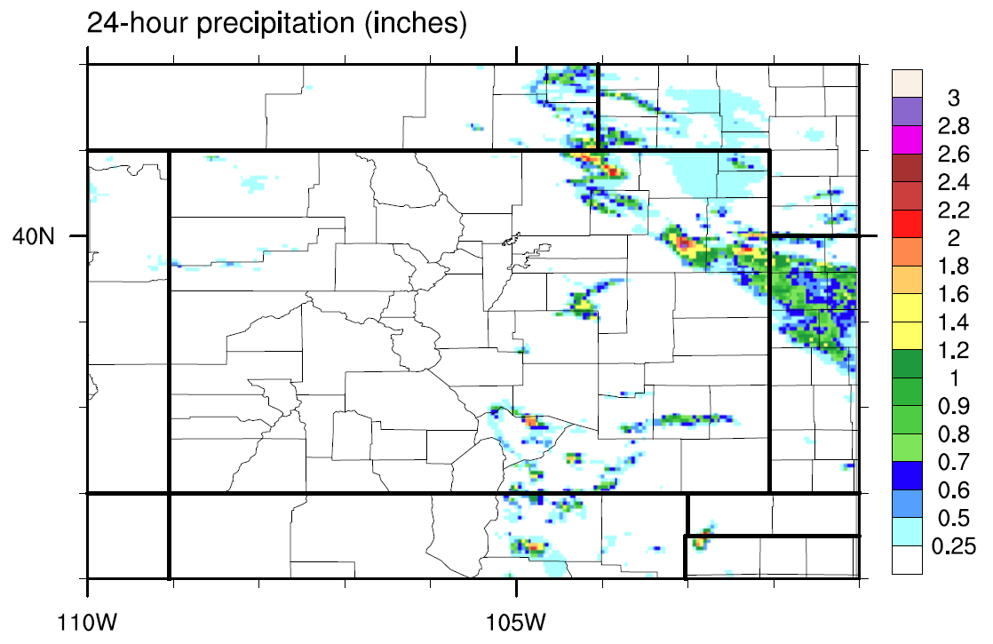
Two features of note – a shortwave disturbance over northern Colorado and a pool of moisture over southeastern Colorado – contributed to the production of widely scattered showers and thunderstorms yesterday afternoon and evening. The strongest storms of the afternoon were over southeastern Colorado, where a couple reports of 0.88-1.00 inch hail was reported in El Paso and Huerfano counties. As the afternoon turned to evening, a couple of stronger thunderstorms rumbled across the Northeast Plains, eventually congealing into a complex of storms that exited the state around 3 AM. Over the High Country, isolated showers/thunderstorms did not have much moisture with which to work, so gusty winds were the main result; 46 mph wind gust was reported at the Craig-Moffat Airport and a 66 mph wind gust was reported 1 mile west of Craig.
No flash flooding was reported yesterday. For a look at precipitation estimates in your area, please see the State Precipitation Map below.
Click Here For Map Overview
The map below is the 24-hour MRMS data. We had technical difficulties with the MetStorm data, so we’ve provided this as the QPE.