Issue Date: Monday, August 26th, 2019
Issue Time: 1:00PM MDT
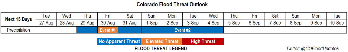
Valid Dates: 8/27 – 9/10
Event #3 of Thursday’s FTO has now become Event #1. There will be one more day (Tuesday) with northwest flow over the state, which will push another cold front through and give way to slightly below average high temperatures. By Wednesday, the 500mb ridge begins to rebuild over the western US, which will mark the next warm up. Temperatures will likely bounce back to the 90°Fs over the lower elevations before the next trough pushes through on Thursday. Looking for rain to return to the forecast first over western Colorado (Thursday) and then to the eastern mountains on Friday and Saturday. Not expecting widespread, heavy rainfall at this time, but rainfall amounts could cause issues for recent burn areas. The best moisture return will be on Friday behind the next (slightly weaker) cold front, so an Elevated flood threat to be issued for this day. Rainfall chances begin to decrease on Saturday as the ridge rebuilds with the best chance for accumulation over the Southeast Mountains and Raton Ridge. Not currently thinking there will be a threat to burn areas over the Southeast Mountains on Saturday, but a lot can change this far out in a forecast.
Event #2 immediately follows Event #1, which begins as a western Colorado event and transitions to the Front Range and Northeast Plains Wednesday and Thursday. Mid-level energy rotating around the high and a PW surge to our east will cause rainfall to return to the western high terrains. The bulk of the moisture looks to be west of the state to begin, but as the ridge axis is pushed slightly eastward by the next trough, this would push some of that moisture into the state. It looks to be a fairly strong ridge that sets up during Event #2, so expecting abnormally high temperatures again with a moderate diurnal temperature swing.
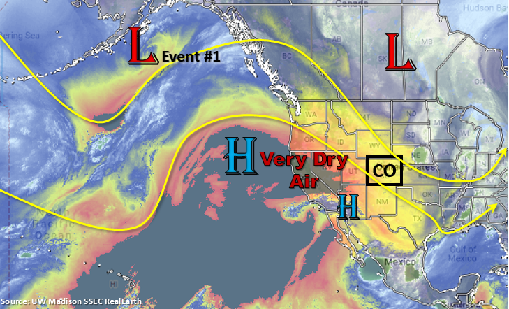
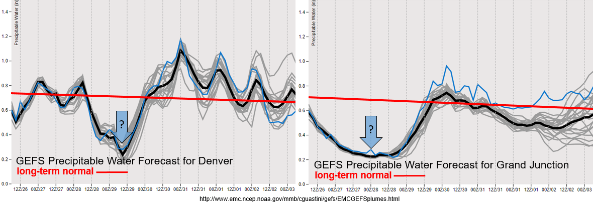
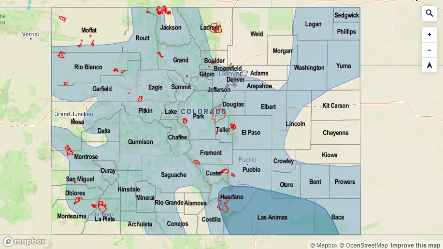
A very dry air mass (black in the water vapor imagery above) begins to move over the state with the northwesterly to westerly flow aloft the next couple of days. We will come close, and may even set, the daily minimum PW records for Denver and Grand Junction (see the blue arrows below). During this period for Denver, the record is between 0.3 and 0.33 inches and for Grand Junction, the record is between 0.25 and 0.27 inches. Thankfully, surface winds aren’t looking to be too strong, so widespread, critical fire weather is not anticipated at this time. Quite the moisture return east and west of the Continental Divide behind the front. Still not quite sure about the depth of the moisture, so this will be something to watch. Nonetheless, storms should reappear in the forecast beginning on Thursday.
Event #1: Thursday (8/29) – Saturday (8/31)
Elevated Threat/No Apparent Threat as a passing trough pushes the ridge axis east and allows moisture to return to the state behind a cold front for afternoon scattered storms.
This event will first begin over western Colorado on Thursday and then transition to the eastern mountains on Friday (and possibly Saturday). Moisture return looks highest behind the front on Friday, so this is when the greatest heavy rainfall threat will be. Models have been decreasing the intensity of the trough over our state the last few days, but a lot of details could change the couple of days. Not too worried about widespread flooding, but rain rates could be high enough to cause issues over the recent burn areas. Please tune into the FTO on Thursday as there will be much more confidence in a 1-day forecast. It looks to dry out and warm up over the weekend as the ridge builds overhead, so it should be a beautiful Labor Day weekend for camping and outdoor activities.

Event #2: Sunday (9/1) – Thursday (9/5)
No Apparent Threat due to weak moisture return as the ridging pattern is broken down.
Not a ton of confidence in this forecast due to it beginning a week out, but an active storm pattern looks to return for Event #2. Right now it looks to mainly be a western Colorado event, which would be great since this region has gotten very dry over the last month or so. Unfortunately, there is equal chance that if storms return to the forecast and PW is only around a half inch (see guidance above), dry thunderstorms would cause some fire concerns. Please check back into the forecast on Thursday as it will likely become clearer which scenario will play out.