Issue Date: Sunday, August 18th, 2019
Issue Time: 9:15AM MDT
Summary:
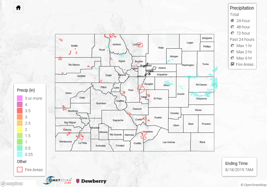
Not much rainfall yesterday as westerly flow mixed out moisture from west to east. Storms that made it into the eastern plains, before falling apart, were able to gain a little strength. Radar showed an area of weak thunderstorms forming over the eastern plains during the afternoon and evening where slightly better moisture was able to hold on. Totals up were just over 0.5 inches with most areas below this mark. Hail reports were up to 1 inch with these storms with the largest hail report around quarter size. There were additional light showers over the Northern Mountains and Northern Front Range, but totals were under 0.25 inches (so they aren’t shown below). The big report of the day was a 65 mph wind gust in Moffat County where there was a Red Flag Warning. Surface winds yesterday ranged from 10 to 25 mph over this area with relative humidity values in the teens. As anticipated, flooding was not reported.
To see estimated precipitation totals over your neighborhood on Wednesday, scroll down the State Precipitation Map below.
Click Here For Map Overview