Issue Date: Thursday, August 15th, 2019
Issue Time: 9:30AM MDT
Summary:
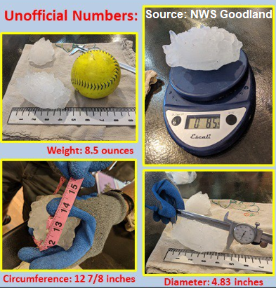
Once again, the main weather story on Thursday was a severe thunderstorm over the far eastern plains. The threat yesterday was over a much smaller area than Tuesday, but the cap was broken and the environment was right for some large hail and strong winds with CAPE and shear parameters fairly high along the border. A Severe Thunderstorm Watch was issued for the Northeast Plains just after 4PM with the lone, large storm of the day gaining strength as it moved in from Wyoming into Yuma County. This storm traveled south along the border and produced 3 inch diameter hail (tea cup size) in Yuma County and a 70mph gust (measurement taken in Kit Carson County near Stratton). Throughout its life cycle, it produced a lot of hail ranging from 1 inch to 2.5 inches, which stripped crops of their leaves. Speaking of hail, it looks like the hail stone from Tuesday might have broken a new state record (not official yet). The hail stone measured 4.83 inches in diameter, which was after 30 minutes after it fell – meaning it was likely bigger! It weighed 8.5 ounces and its widest circumference was 12 7/8 inches. Take a look at the photo from the Goodland NWS office below.
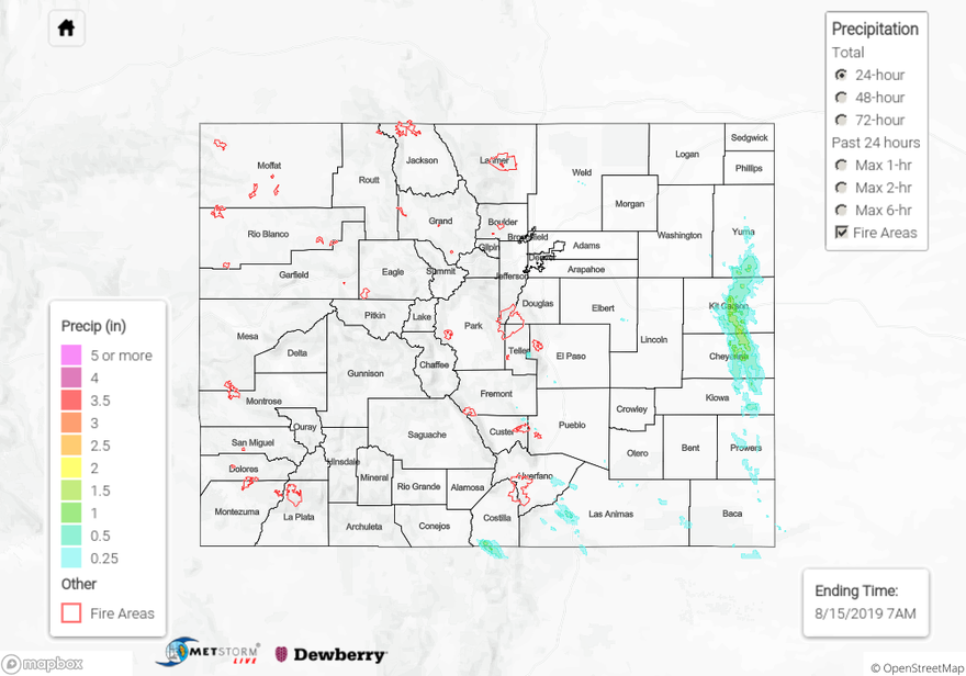
As far as rainfall totals, the storm over the eastern plains had max 1-hour rain rates up to 1.65 inches. Additional storms that fired along the Southeast Mountains, and moved over the Raton Ridge, produced totals up to 0.6 inches. One stationary storm along the southern edge of Costilla County had an Areal Flood Advisory at 6:30PM. Radar estimates a small area received up to 1.2 inches of rain with 1-hour rain rates just under 1 inch, but there were no flooding reports as of this morning or observations in the area.
To see estimated precipitation totals over your neighborhood on Wednesday, scroll down the State Precipitation Map below.
Click Here For Map Overview