Issue Date: Wednesday, August 14th, 2019
Issue Time: 10:20AM MDT
Summary:
Tuesday was another busy day on the severe weather front, which was not too surprising given the atmospheric pattern. A strong dry line setup over the eastern plains with westerly flow aloft, and helped produce some very strong thunderstorms in a high shear and CAPE environment. Storm motion was fairly quick to the southeast, but there were still some impressive 1-hour totals (around 2.25 inches)! A tornado watch was issued for the Northeast Plains at 1PM and the storms initiated shortly after along the boundary. The storm produced a couple of tornado touchdowns in Yuma and Kit Carson Counties, but hard to tell in some pictures due to the tornado being rain wrapped. Large hail also accompanied the storms. There was a ~5 inch diameter hailstone reported in Bethune via Twitter. This will still need to be verified, but if it does, this will be a new state record. See: https://climate.colostate.edu/records.html for more information about hail records. There were several other reports of large hail with these storms ranging from 1.75 inches to 2.75 inches
Not surprisingly, there was flooding reported near Burlington where radar estimates around 1.75 inches fell. There were two Flash Flood Warnings for the County between 3 and 6PM. A CoCoRaHS station in town recorded 1.34 inches for the event. In Stratton, CO (north, central Kit Carson County) there was a CoCoRaHS station that reported 1.58 inches, which was the highest report of the day for the eastern plains. Storms then moved south along the tail end of the MCS in Kansas caused some more rainfall over the Southeast Plains. Additional storms fired with these outflow boundaries over the area in the high moisture environment. Radar indicates just over 1 inch fell with more general storm totals around 0.6 inches. Light to moderate rain continued into this morning.
An outflow boundary from the Northeast Plain storms initiated another set of thunderstorms over the northern Front Range and adjacent plains. When it pushed back west, it broke the cap over the foothills. Hail between 1 and 1.25 inches fell between 10 and 11PM over the Weld/Larimer/Boulder County intersect. A rain gage just south of Wellington picked up 0.5 inches along with an ALERT gage in Longmont. Radar indicates up to 1.5 inches of rain fell just southeast of Longmont. There was no flooding reported with these storms as of this morning.
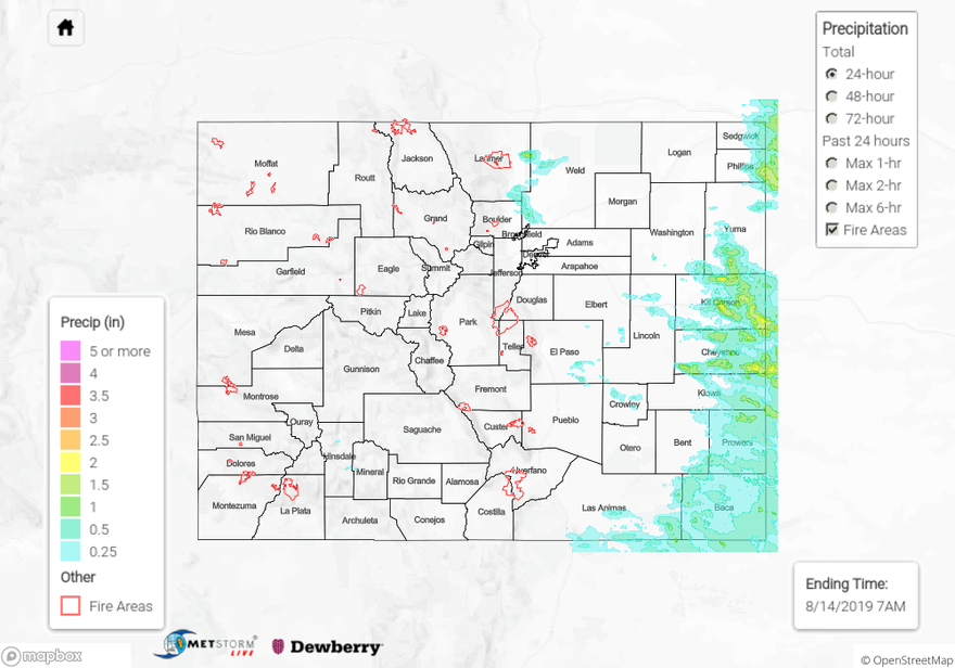
To see estimated precipitation totals over your neighborhood on Tuesday, scroll down the State Precipitation Map below.
Click Here For Map Overview