Issue Date: Wednesday, August 7, 2019
Issue Time: 10:50AM MDT
Summary:
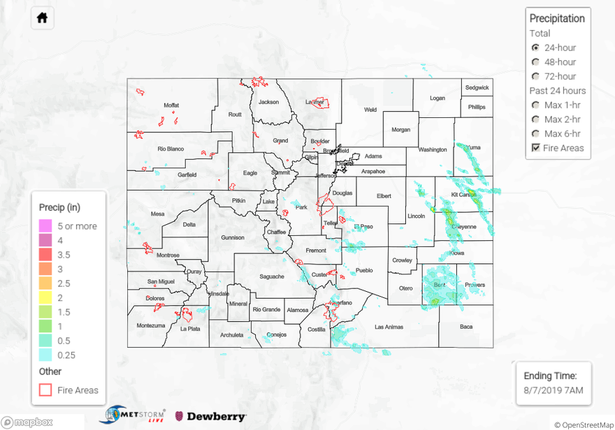
A brief round of isolated severe thunderstorms moved south over the far eastern plains along a dryline late yesterday and early this morning. Storms were very high based, creating isolated areas of heavy rainfall. Hail up 0.7 inches in diameter was reported to have lasted for 10 minutes to the west of Kit Carson in Cheyenne County. Radar derived up to 2 inches of rain over Kit Carson and eastern Lincoln Counties last night, however surface reports throughout the area are sparse, so estimates may have been contaminated by hail. The highest surface report over the eastern plains yesterday was measured by a CoCoRaHS station in Kiowa County near Eads, at 0.73 inches. Severe thunderstorms over Bent County prompted the issuance of an Areal Flood Advisory by the NWS at 8:45 PM, however no flooding was reported over the area. Isolated storms over El Paso County produced 24-hour rainfall totals up to 0.39 inches near Colorado Springs. Radar derived up to 0.5 inches of rain over the northern edge of the Spring Creek burn area, however a CoCoRaHS station measured only 0.12 inches, implying that the storms were likely high based as well.
Back to the west it stayed pretty dry over most areas, with the exception of the Southwest Slope and southern San Juan Mountains. Pockets of moisture came into the area from the southwest, providing moderate 24-hour totals over Montezuma, La Plata and Archuleta Counties. An isolated thunderstorm late yesterday afternoon produced between 0.4 and 0.77 inches of rain near Pagosa Springs over a two hour period. Trace amounts of rainfall were measured over the Grand Valley, Northwest Slope, Central Mountains and Northern Mountains. An isolated thunderstorm produced wind gusts up to 45 mph near Craig in eastern Moffat County. No flooding was reported yesterday.
For a look at precipitation over your area, please visit the State Precipitation Map below.
Click Here For Map Overview