Issue Date: Monday, August 5th, 2019
Issue Time: 4:00PM MDT
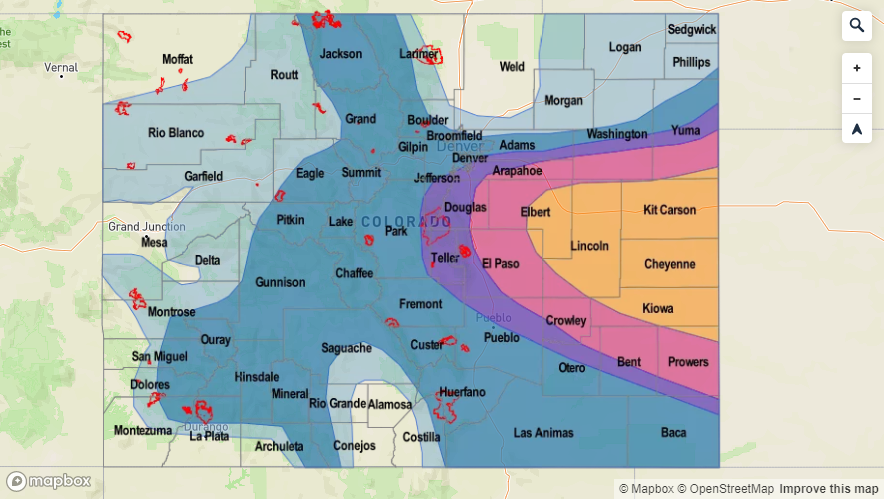
Valid Dates: 8/6 – 8/20
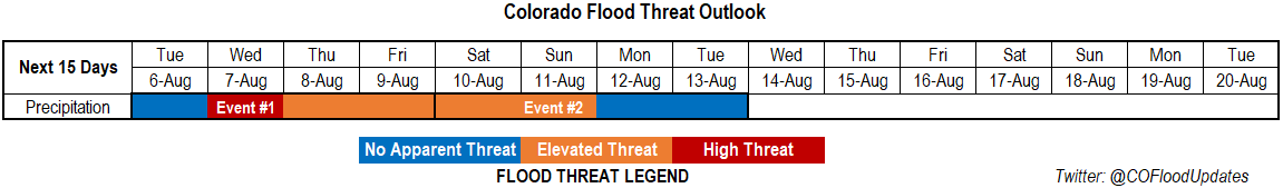
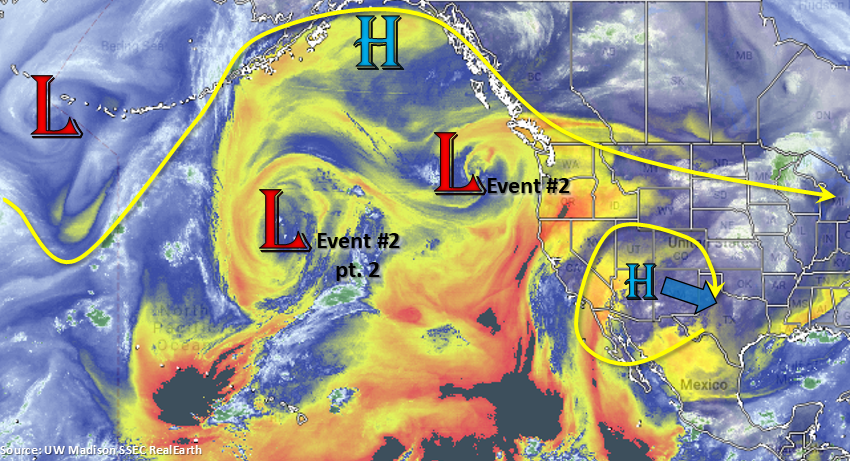
There is lull in heavy rainfall tomorrow before a High/Elevate flood threat is issued through this weekend. Taking a look at the water vapor imagery below, quite a bit of dry air circulating up and around the Pacific and west coast. It is usually a bit more concentrated in nature with stronger drying near the equator. With the subtropical high over Arizona, some of that dry air (yellow/orange) has worked its way into western Colorado. This has decreased the chances for rainfall from Sunday to today, and it will continue to do so through tomorrow. Event #1 kicks into full gear on Wednesday as the ridge begins to get squashed and a cold front is pushed through eastern Colorado. This is due to multiple shortwaves rotating around the high/low (labelled Event #2), which will also help enhance lift for widespread coverage of afternoon and evening storms. Lee troughing on Wednesday and Thursday will also help return low level moisture to eastern Colorado on its north side. However, low level moisture on its east side will likely stay over Kansas. More westerly steering flows will allow storms to move into the adjacent and eastern plains, so some heavy rainfall and marginal severe weather may be possible on both days. Thus, there is a High/Elevated flood threat issued through Friday.
After Friday, the high begins to rebuild over Texas. This will pull more Gulf of Mexico moisture into eastern Colorado, creating a PW surge. At this same time, the low pressure system marked below begins to move inland. This is expected to increase shortwave activity and southwest flow this weekend. The associated jet may also create some fire weather danger concerns over northwest Colorado, but there is lower confidence in that forecast as this time. More zonal flow behind the trough will mix out moisture, so there is No Apparent Threat and a break in heavy rainfall forecast to start next week.
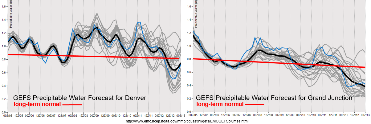
First thing that catches my eye about the images below is that average PW is starting to decrease (red line), which means climatologically, the monsoon starts to taper off. The second thing is the variability between model members after Wednesday (gray lines), which just means there is more uncertainty in my forecast for this weekend. With that said, there is quiet the moisture return after the passage of the cold front on Wednesday over eastern Colorado. Paired with an increase in dynamic (shortwaves, boundary, etc.), heavy rainfall will be likely and may last overnight on Wednesday over the eastern plains. The moisture sticks around on Thursday, but storms will likely be confined to the mountains due to capping over the eastern plains. With favorable dynamics in place over the weekend and Gulf of Mexico moisture likely over eastern Colorado (if the high reforms over Texas), thinking PW will be on the higher end of climatology. Thus, the Elevated flood threat.
To the west, there is a slight increase in moisture on Wednesday and Thursday as well, although not quite as much as the last couple of systems. The subtropical high will be in an unfavorable location to produce widespread heavy rainfall. Nevertheless, expecting these days to have the greatest coverage of storms over the higher terrains. Quite the downtick in moisture through this weekend into next week. If the moisture drops off before the approaching low (and associated jet stream), there might be an increase in fire danger over the northwest corner at the end of this weekend into early next week.
Event #1: Tuesday (8/6) – Friday (8/9)
High/Elevated Threat as post frontal upslope flow and numerous shortwaves combine for favorable heavy rainfall environment.
Discussed this event quite a bit above, but I will add a few more details down here. On top of high moisture and favorable dynamics, storm motion is expected be very slow over the eastern high country and adjacent plains on Wednesday. Thus, some very heavy accumulations should be expected under storms that form, especially over the eastern plains (isolated totals > 2.5 inches). Surface based CAPE and decent directional and speed shear (shifting of winds with height) may cause storms along the Palmer Divide and east to produce some large hail and strong winds as well. The hail threat will decrease as instability lessens a couple of hours after sundown. Recent burn areas, especially the Spring Creek burn scar, will be monitored closely in the FTB throughout this event as rain rates could be high enough to cause flash flooding and mud flow issues. To the west, the best chance for flooding rain rates over the Lake Christine and 416 burn areas will be on Wednesday. More isolated coverage on storms on Thursday should decrease the overall flood threat to the west including the burn areas. Please be sure to tune into the FTO on Thursday for the latest and follow the FTB for the daily flood threat update.

Event #2: Saturday (8/10) – Tuesday (8/13)
Elevated Threat as the ridge begins to rebuild over Texas, which returns high PW values to eastern Colorado.
With the more southern and eastern position of the subtropical high, this event will favor heavier rainfall over eastern Colorado. The ridge is weaker than usual over the state for this event, which mean weaker easterlies for upslope flow. The main flood threat for this event will be storms that make it further east under the westerly and southwesterly steering flows. If the peak in diurnal heating coincides with a passing shortwave over the adjacent plains, coverage of the heavy rainfall is forecast be much greater with some severe thunderstorms likely. The right entrance of the jet region will also be watched closely as this could cause some storms to linger overnight, which would increase accumulations. As mentioned before, lower confidence this far out and with varying model members. Please tune back into the FTO on Thursday as details will become clearer.