Issue Date: Thursday, July 25, 2019
Issue Time: 10:50AM MDT
Summary:
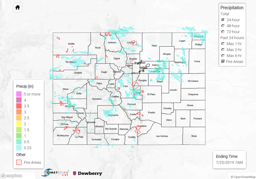
There were multiple reports to the NWS of flash flooding near the Spring Creek burn area yesterday. Slow moving storms over a saturated surface environment caused flash flooding after radar derived up to 0.5 inches of rain over a 2 hour period. Reports include railroad tracks washed out near Fir, flooding over and on County Road 440, and flooding along South Abeyta Creek and County Road 442. No injuries were reported due to the flooding. High levels of moisture from the west-southwest moved over the high country yesterday, producing thunderstorms throughout the area. Areal Flood Advisories were issued over Teller County, Ouray County and Mineral County, however no flooding was reported over these areas. Surface CoCoRaHS stations in La Plata County near Durango and Dolores County near Dove Creek reported up to 0.68 and 0.69 inches respectively.
The highest rainfall yesterday occurred in Teller County, with CoCoRaHS reporting 0.91 inches. A cold front passed over the Northeast Plains mid-afternoon yesterday, bringing rain to the Front Range, Urban Corridor, Northeast Plains and Palmer Ridge. Rainfall between 0.1 and 0.6 inches was measured over and near the foothills. The highest surface accumulation to the east of the foothills was measured in Arapahoe County at 0.79 inches. Radar derived up to 1 inch over Arapahoe, Adams and Washington Counties, however drier air at the surface likely evaporated some of the rain prior to it arriving at the surface.
For a look at precipitation in your area, please use the State Precipitation Map below.
Click Here For Map Overview
Note: The 24-hour, 48-hour and 72-hour total precipitation do not contain bias corrections today due to more realistic spatial coverage of rainfall (from observations) over the higher terrains of the Southeast Slope and San Juan Mountains.