Issue Date: Saturday, August 1st, 2020
Issue Time: 09:30AM MDT
— Flooding is NOT expected today
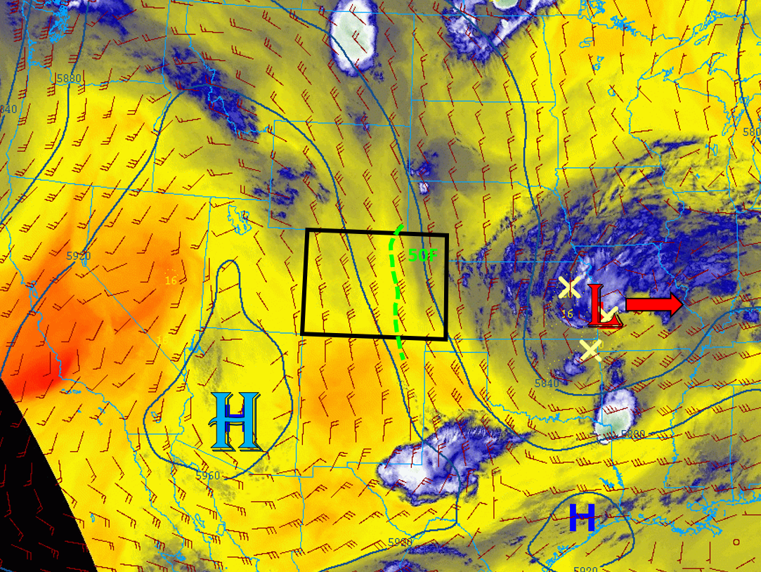
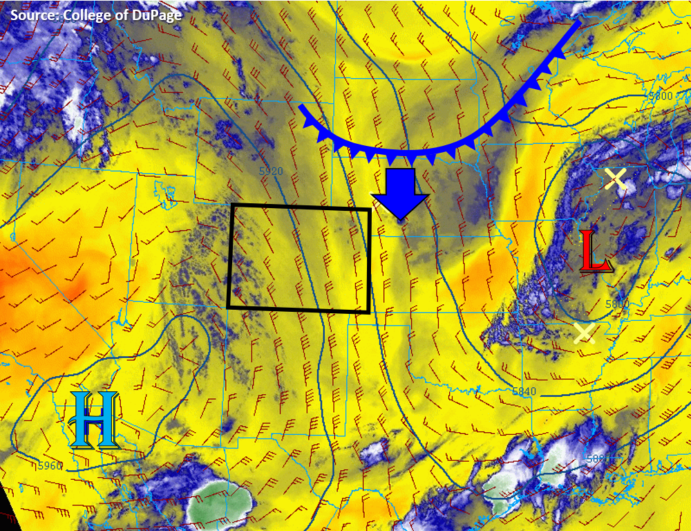
Today’s weather setup looks very similar to yesterday as we remain under north-northwesterly flow aloft due to being crammed between a high amplitude upper-level ridge to the west and a trough to the east (see satellite image below). The satellite water vapor imagery below indicates Colorado is not in extremely dry air (light blue rather than orange/yellow), but this morning’s soundings only show 0.6 inches of PW at Denver and Grand Junction, a slight decrease since yesterday for Denver and a slight increase for Grand Junction. However, the moderate north-northwest flow is not transporting high amounts of moisture into Colorado as conditions look similar along the eastern Rockies up into Montana. Surface dew points this morning show a gradient from west to east, with western Colorado showing drier 30Fs and eastern Colorado upper 40Fs to mid 50Fs. This means higher chances for rain-producing thunderstorms exists over the eastern half of Colorado today. Little cloud clover is evident over Colorado this morning, which will allow plenty of diurnal heating and mixing in the boundary layer. This mixing will lower surface dew points into the 40Fs for the eastern plains of Colorado. However, there should be plenty of moisture and instability for high-based thunderstorms to develop over the mountains this afternoon, especially over the Front Range, Southeast Mountains, and southern San Juan Mountains. But, due to the higher cloud bases and plenty of sub-cloud evaporation, heavy rainfall capable of causing flooding is not expected today.
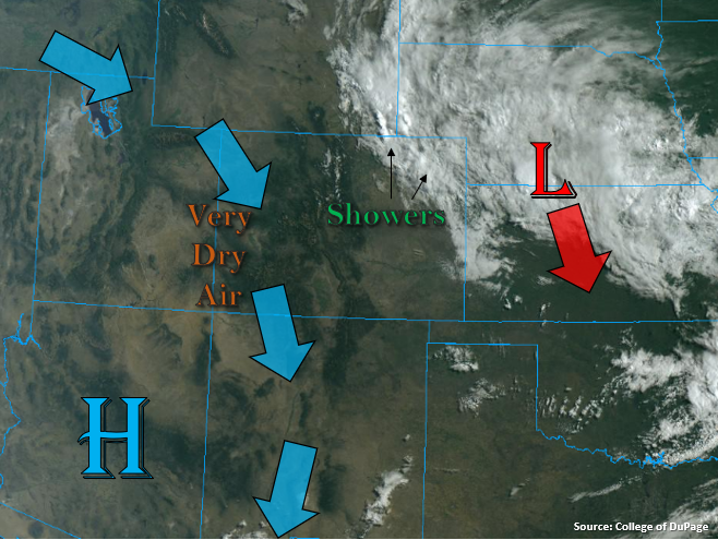
Overnight and early morning showers and thunderstorms may be possible along the Northeast Plains as a cold front sags its way south. This current cold front is located across South Dakota and has been labeled on the image below. This front will push in cooler and more moist air from the north and act as a convergence boundary where showers and storms could develop, but due to its overnight and early morning arrival, instability will be limited. This should keep rain rates below 0.6 in/hr. No flooding is expected from these showers and storms.
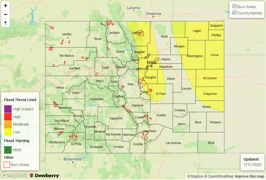
Today’s Flood Threat Map
For more information on today’s flood threat, see the map below. Hover over the threat areas for more details, and click on burn areas to learn more about them. For Zone-Specific forecasts, scroll below the threat map.

Zone-Specific Forecasts:
Northern Mountains, Central Mountains, San Juan Mountains, Front Range, Southeast Mountains, San Luis Valley, Raton Ridge, Urban Corridor, Palmer Ridge, Northeast Plains, & Southeast Plains:
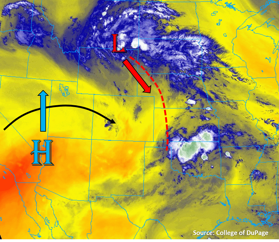
Scattered thunderstorms will develop this afternoon over the mountains and track south-southeast into the adjacent plains. Storms could produce max rain rates up to 0.2 in/hr west of the Continental Divide and up to 0.7 in/hr east of the Divide. The highest chances and coverage of storms will be over the Front Range, Southeast Mountains, and southern San Juan Mountains. Due to moderate storm motions and dry sub-cloud air, flooding is not expected over the mountains and adjacent plains. Some small hail and gusty winds up to 50 mph are possible with the stronger storms.
Overnight and early morning showers and possible in the Northeast Plains as a cold front moves into the area. Rain rates up to 0.6 in/hr are possible, but flooding is not expected.
Primetime: 1PM to ongoing
Northwest Slope, Grand Valley, & Southwest Slope:
Partly cloudy and warm today with high temperatures near 100F for lower elevations of the Grand Valley. Some weak storms may fire over the high terrain, but rain rates should stay below 0.2 in/hr. No flooding is expected today.