Issue Date: Monday, May 3rd, 2021
Issue Time: 9:50AM MDT
— Flooding is NOT expected today
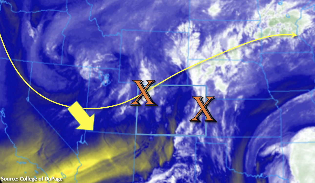
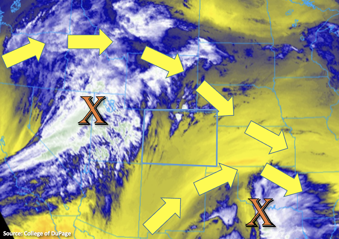
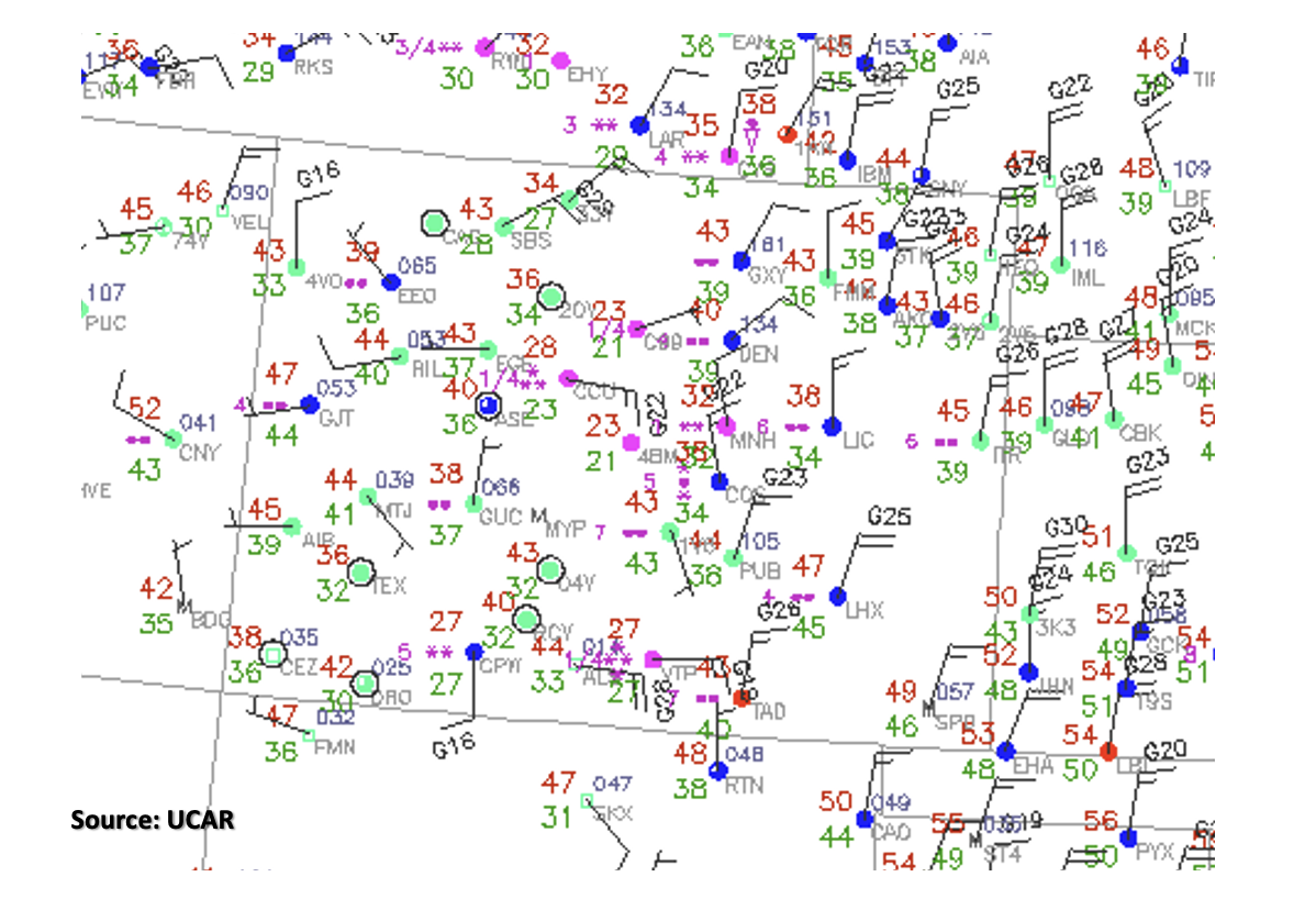
The surface observations from 8AM this morning show almost completely overcast conditions across the state (filled in circles) and much cooler temperatures behind yesterday’s cold front (red numbers). This is about a 20 to 30 degF drop from this weekend, so you know it must be springtime in Colorado. Precipitation continues over and near the higher terrains with the trough near the four corners region helping to produce orographic lift. The snowline has dropped slightly below the 7,000 ft contour along the Front Range, and precipitation over the mountains is falling as snow (* symbol).
Expect these conditions to continue today and expand in coverage this morning into early afternoon as the open trough moves east. Although there is plenty of moisture and lift available for widespread precipitation, limited instability means that rainfall at the lower elevations will be more wetting in nature rather than convective. This paired with snow at the high elevations means there is no flood threat issued today. The pulse-like showers and snowfall are expected to gradually come to an end by tomorrow morning.
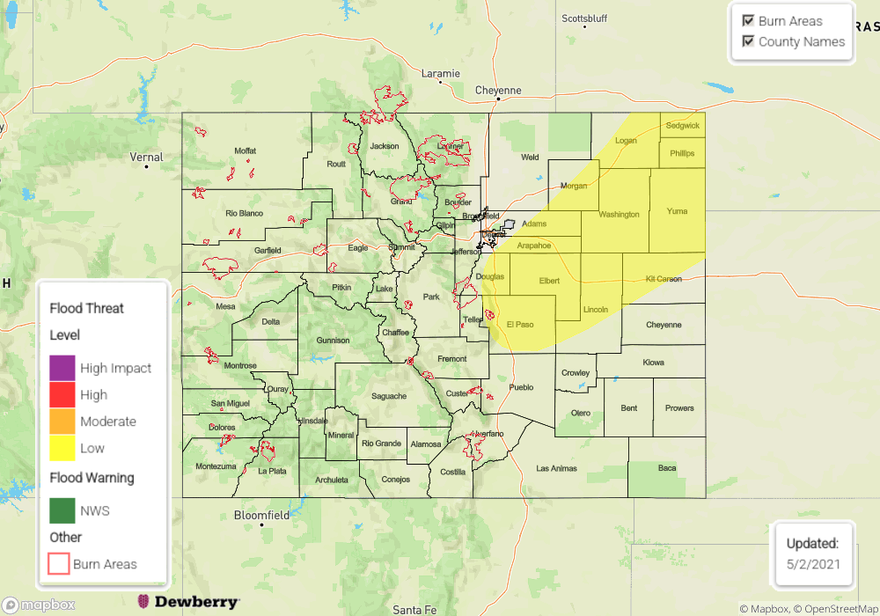
Today’s Flood Threat Map
For more information on today’s flood threat, see the map below. Hover over the threat areas for more details, and click on burn areas to learn more about them. For Zone-Specific forecasts, scroll below the threat map.
Zone-Specific Forecasts:
Northern Mountains, Front Range, Southeast Mountains, Central Mountains & San Juan Mountains:
Quite a bit of wet and heavy snow is expected this afternoon as the base of the trough, or center of energy, moves east. Generally, snowfall accumulation will be in the 6-12 inch range with local higher totals possible. The Central Mountains look to get between 0.75 and 1.50 inch of precipitation, whereas the San Juan Mountains could see the same, but will be more isolated. Over the Front Range and Southeast Mountains, isolated totals up to 1.25 inches of precipitation are possible by morning. With precipitation falling as snow, flooding is not forecast. Tune into your local NWS for the latest on winter weather advisories and warnings.
Primetime: Ongoing to 2AM
Northeast Plains, Urban Corridor, Southeast Plains, Raton Ridge, & Palmer Ridge:
A dreary day is ahead for areas along and near the mountains, so expect rain across these lower elevations. As the system continues to move slowly eastward into tonight, the shortwave looks to weaken. So, generally, only about a 0.20 to 0.40 inches of rain are expected over the eastern Raton/Palmer Ridge and far southeast corner of the state, but isolated totals up to 0.75 inches are possible. Isolated totals along the Urban Corridor and areas just east of the Southeast Mountains could be slightly higher in the 0.75 to 1 inch range, but generally expect totals in the 0.25 to 0.50 inch range. Due to the gradual nature of the rainfall, flooding is not expected. However, there may be some localized, light ponding due to compounding rainfall.
Primetime: Ongoing to Midnight
Grand Valley, Northwest Slope, Southwest Slope & San Luis Valley:
Fairly widespread rainfall will continue today for the lower elevations of the Northwest Slope and Grand Valley. Isolated totals around 0.40 inches will be possible and totals over the higher elevations could reach 1 inch. Isolated areas of lower elevations in the Southwest Slope may see up to 0.15 inches by morning, and the higher elevations could just under 0.50 inches. Flooding is not forecast due to the gradual nature of the rainfall.
Primetime: Ongoing to 10PM