Issue Date: Saturday, June 12th, 2021
Issue Time: 8:45AM MDT
— Flooding is NOT expected today
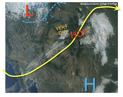
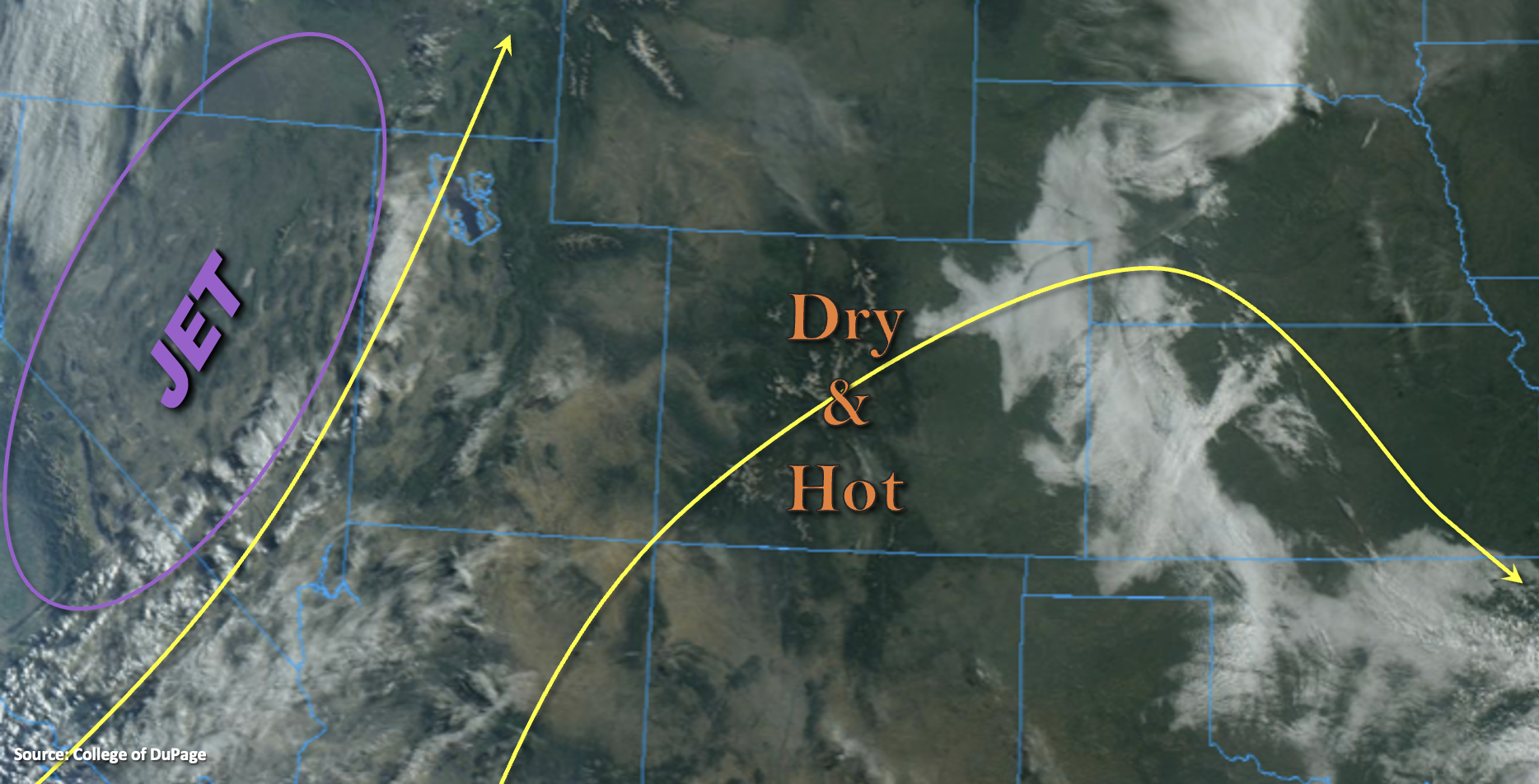
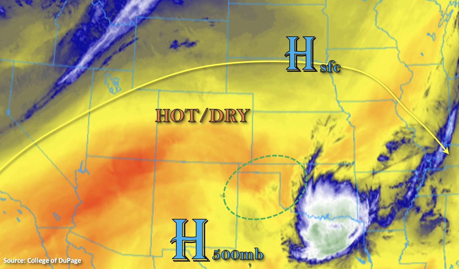
The building High pressure (south) means that temperatures will be on the rise today. With the increasing heights and the same dry air mass as yesterday in place, the majority of the state will be rain-free again this afternoon and evening. Best chance for an isolated storm or two will be over the Raton Ridge and far southeast corner of the state. Higher surface dew points exist behind yesterday’s front in the area outlined in green below. A surface High over Nebraska and South Dakota will help reinforce southwesterly flow across this region, which should pull some of this surface moisture back across the border. The initial threat from the stronger storms that develop will be hail and brief heavy rainfall, but the dry mid-levels will likely change this threat to wind fairly quickly. The dry air aloft will also help to limit rainfall rates in the small storm cores. Thus, there is no flood threat issued.
Today’s Flood Threat Map
For more information on today’s flood threat, see the map below. If there is a threat, hover over the threat areas for more details, and click on burn areas to learn more about them. For Zone-Specific forecasts, scroll below the threat map.
Zone-Specific Forecasts:
Southeast Plains & Raton Ridge:
A couple isolated storms may develop over the Raton Ridge this afternoon. As they drift east/southeast around the High, they will likely strengthen as they move into an area of higher dew points. Dry mid-levels will likely limit rainfall rates despite some higher dew points in the area. Max 1-hour rain rates up to 0.75 inches may be possible. The main threat from the storms will be hail and strong outflow winds. Flooding is NOT forecast.
Primetime: 2:30PM to 11PM
Northeast Plains, Southeast Mountains, Front Range, San Luis Valley, Palmer Ridge & Urban Corridor:
Dry day ahead and warming up this afternoon. Highs are forecast to reach into the upper 80Fs and low 90Fs over the I-25 Corridor and eastern plains. With increasing heights and low moisture availability (PW at 0.38 inches in Denver), rainfall is not forecast. Outside of scattered cumulus this afternoon over the mountains and ridges, expect clear conditions.
Southwest Slope, Northwest Slope, San Juan Mountains, Central Mountains, Northern Mountains & Grand Valley:
Temperatures will be on the upswing this afternoon with scattered cumulus clouds forecast to develop over the mountains (south). Highs could reach the mid 90Fs over the lower elevations with mid to upper 80Fs for the mountain valleys. Smoke will likely continue to limit visibility and affect air quality, although the near surface smoke looks to mix out by early afternoon. Rainfall is not forecast today.