Issue date: Sunday, May 31st, 2015
Issue time: 9:10AM MDT
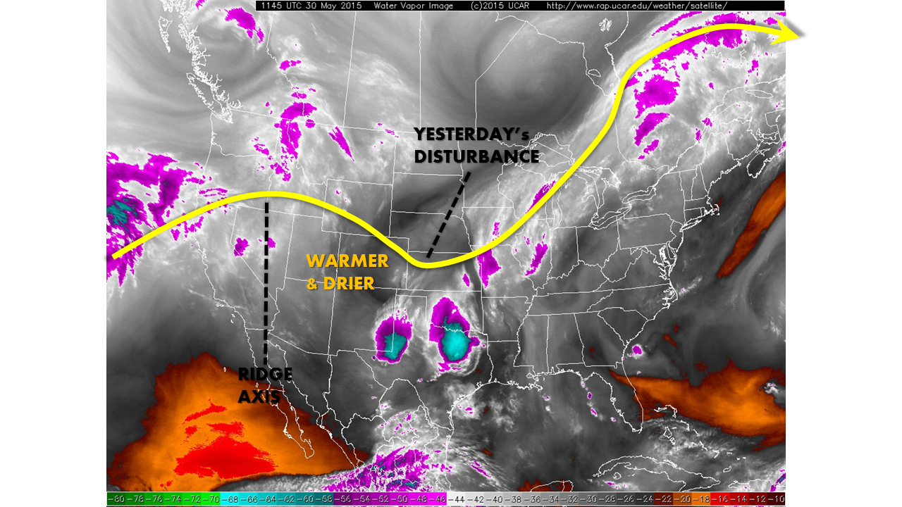
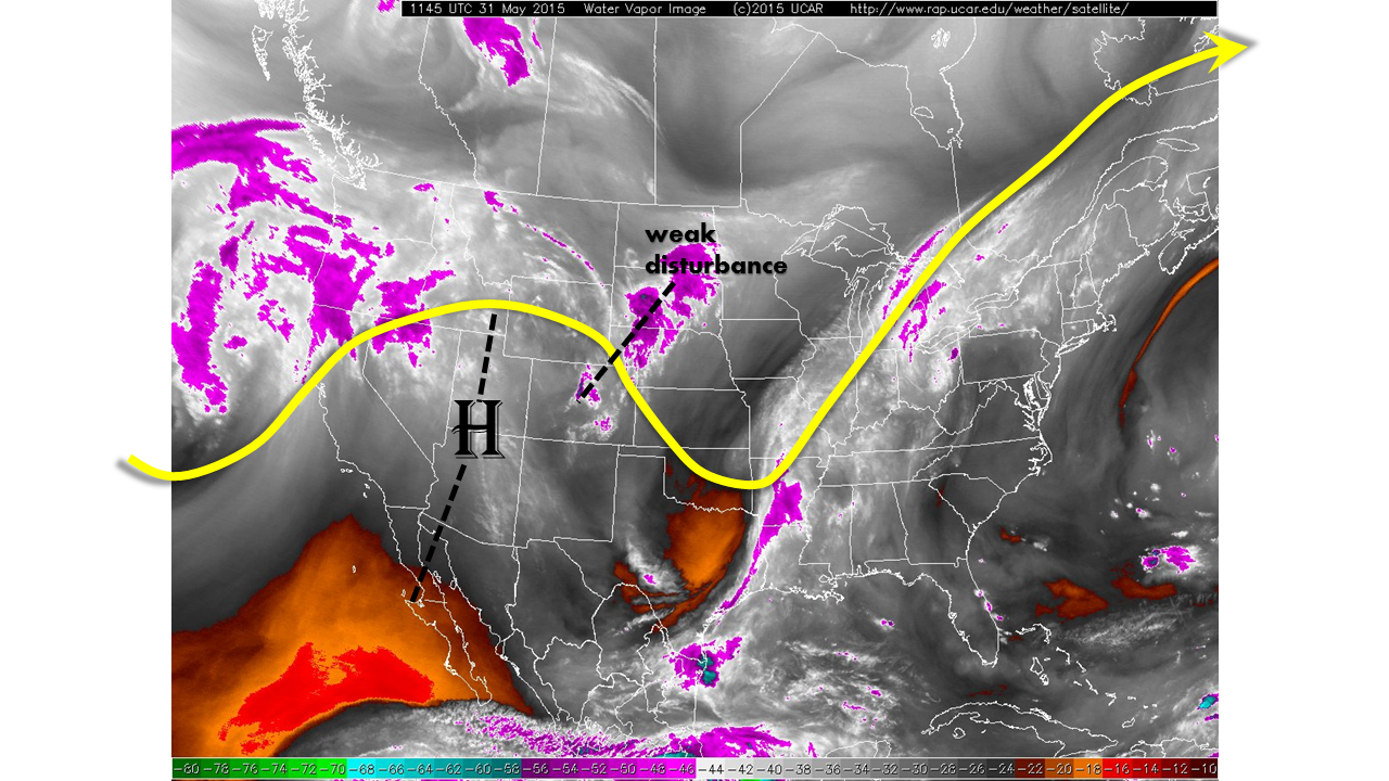
For the second day in a row, Colorado remains under the influence of an upper-level ridge, as shown in the water vapor image below. True to its nature, the high pressure is inducing downward motion resulting in a fairly dry atmosphere. Though dewpoint temperatures this morning are in the 40s and even 50s, the moisture is very shallow. Just a few thousand feet off the ground, the relative humidity values are only 10-20%. There is, however, a weak disturbance noted on the water vapor image. As this disturbances treks southeastward, it may help organize scattered thunderstorms in eastern Colorado. The limited moisture will keep rainfall rates below 1 inch per hour, and no flood threat is anticipated today.
The Arkansas River continued to slowly recede yesterday, and only one official gauge, at La Junta, remains in Minor flood status. We have removed our Low flood threat for the Arkansas because the hot and dry weather is expected to further promote the river’s lowering.
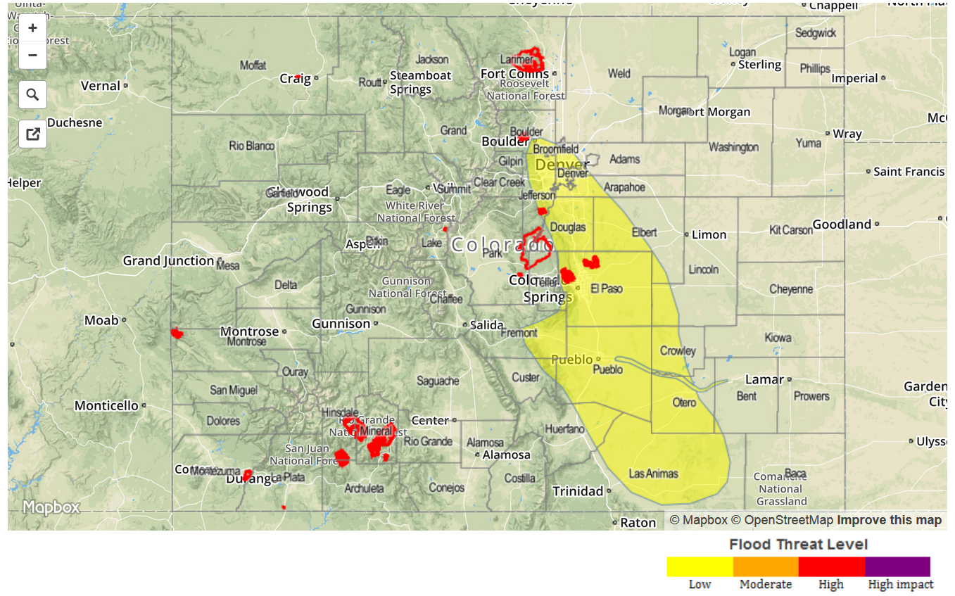
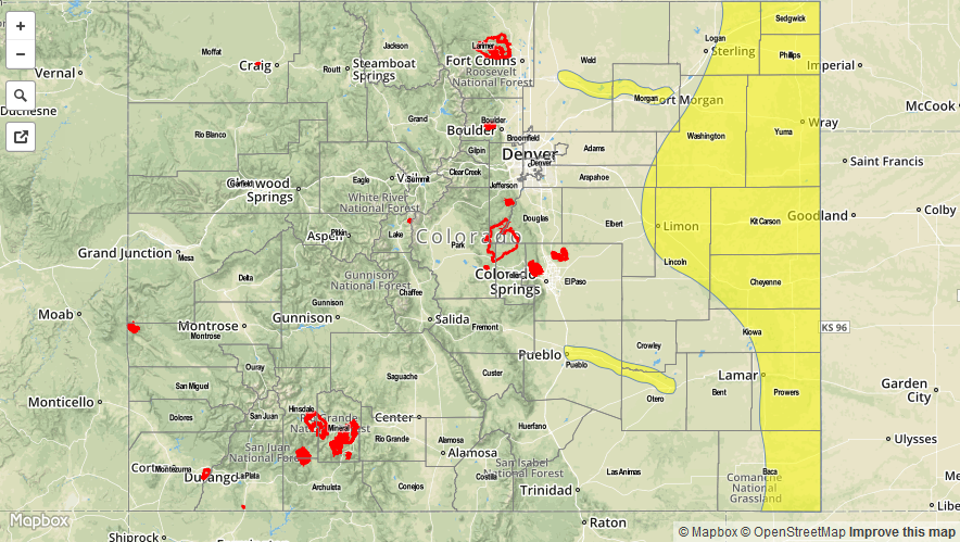
Today’s Flood Threat Map
For more information on today’s flood threat, see the map below (hover over threat areas for more details). For Zone-Specific forecasts, jump below the map.

Zone-Specific Forecasts
Southwest Slope, Northwest Slope, Grand Valley, and San Luis Valley:
Mostly sunny and very warm with temperatures rising into the low to mid 90s in the lowest elevations. No flood threat is expected today.
Northern Mountains, Central Mountains and San Juan Mountains:
Mostly sunny to partly cloudy with isolated to scattered thunderstorms possible by early afternoon. Hourly rain rates will be 0.3 inches or less, so no flooding is expected.
Front Range, Urban Corridor, Northeast Plains, Palmer Divide, Southeast Plains, Southeast Mountains, Raton Ridge:
Mostly sunny early, then becoming partly cloudy with isolated thunderstorms developing by early afternoon. Maximum hourly rain rates will be 0.4 inches close to the mountains, increasing to 0.8 inches farther east. However, the strongest storms will be very isolated in nature, and no flooding is expected.