Issue Date: 6/30/2015
Issue Time: 9:45AM
Flooding is NOT expected today.
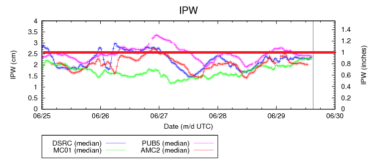
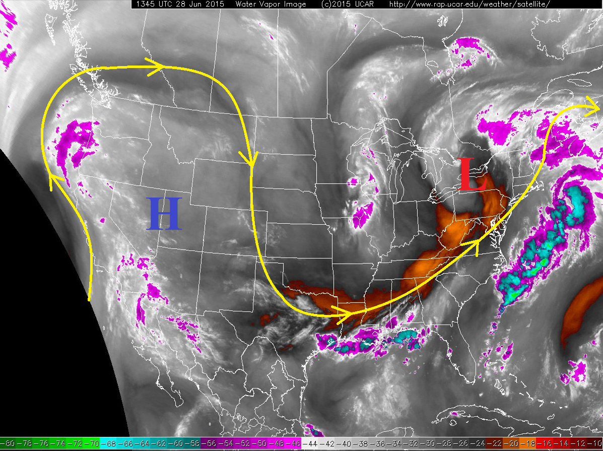
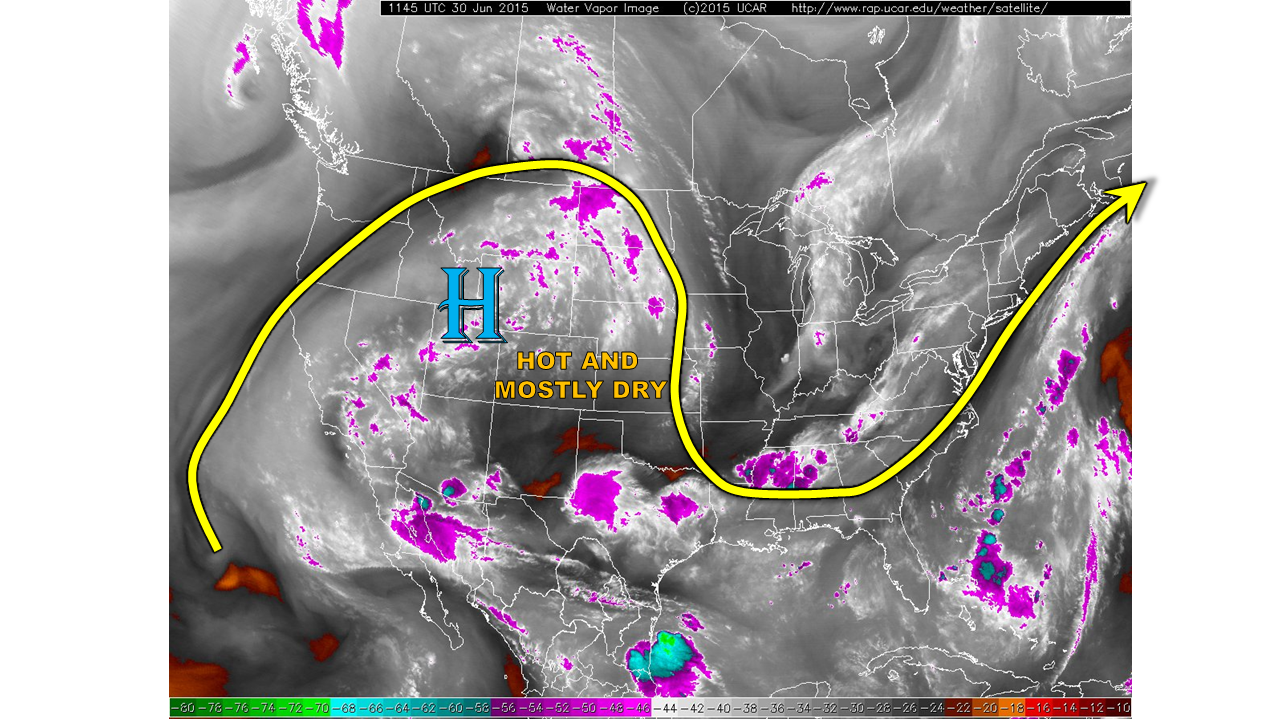
The active month of June will end with a twist as generally dry, and very hot weather is expected today. This is all courtesy of an impressive, though temporary, ridge of high pressure parked just west of Colorado, as shown by the water vapor image below. The ridge will promote very warm mid and upper-level temperatures: for example, the freezing level today will be around 20,000 feet. Because surface moisture still exists, with morning dewpoints in the 40s to low 50s, there will be some isolated to widely scattered thunderstorms. However, with precipitable water falling from 0.6-0.8 inches this morning to about 0.5 inches by late afternoon, we expect rainfall to stay below 0.5 inches. Hikers: do not forget that thunderstorms can produce lightning even without rainfall!
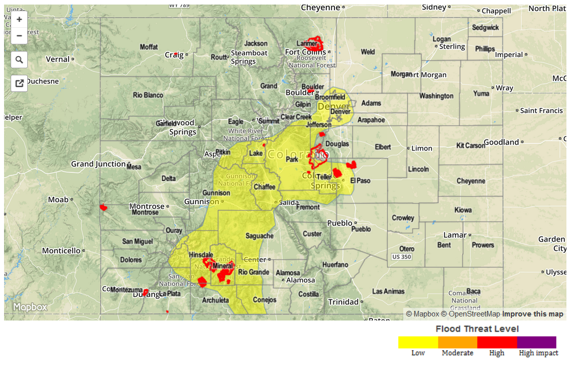
Today’s Flood Threat Map
For more information on today’s flood threat, see the map below (hover over threat areas for more details). For Zone-Specific forecasts, jump below the map.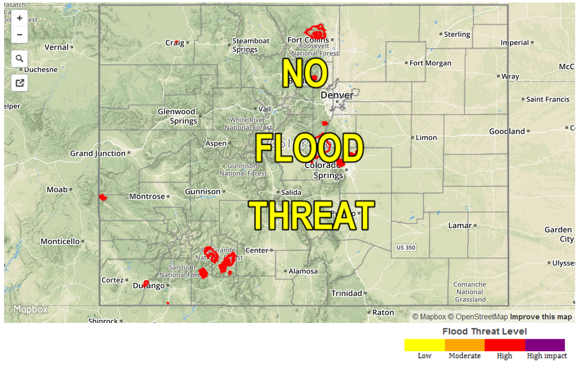
Zone-Specific Forecasts
Grand Valley, Northwest Slope, Southwest Slope, San Luis Valley:
Mostly sunny and very hot today with high temperatures up to 105F in the lowest elevations. An isolated thunderstorms coming from the higher terrain is not impossible, but will produce more of a gusty wind and lightning threat that any rainfall.
Central Mountains, Northern Mountains, Front Range, Southeast Mountains, San Juans:
Mostly sunny early, then partly cloudy and warm with isolated to widely scattered thunderstorms forming by mid afternoon. Hourly rain rates are expected to stay below 0.5 inches, and no flooding is expected.
Northeast Plains, Urban Corridor, Palmer Ridge, Southeast Plains, Raton Ridge:
Mostly sunny early with a few clouds forming by early afternoon. An isolated thunderstorm cannot be ruled out, especially by the Wyoming border. However, rainfall will stay below 0.25 inches and no flooding is expected.